The second section of our trip could have potentially been completed in 5 days but with the low water level and low cfs (cubic feet per second) flow rate it took us 6 days. As a comparison, early season flow rates on the Green River can be around 30,000 cfs while the rate for our trip was about 1,900 cfs!
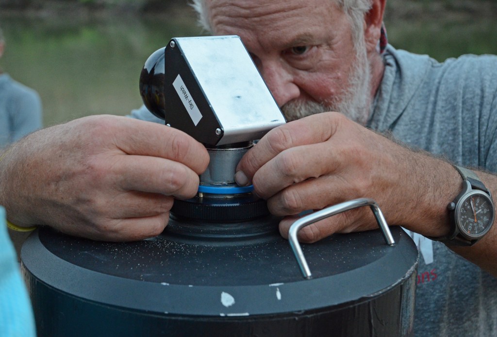
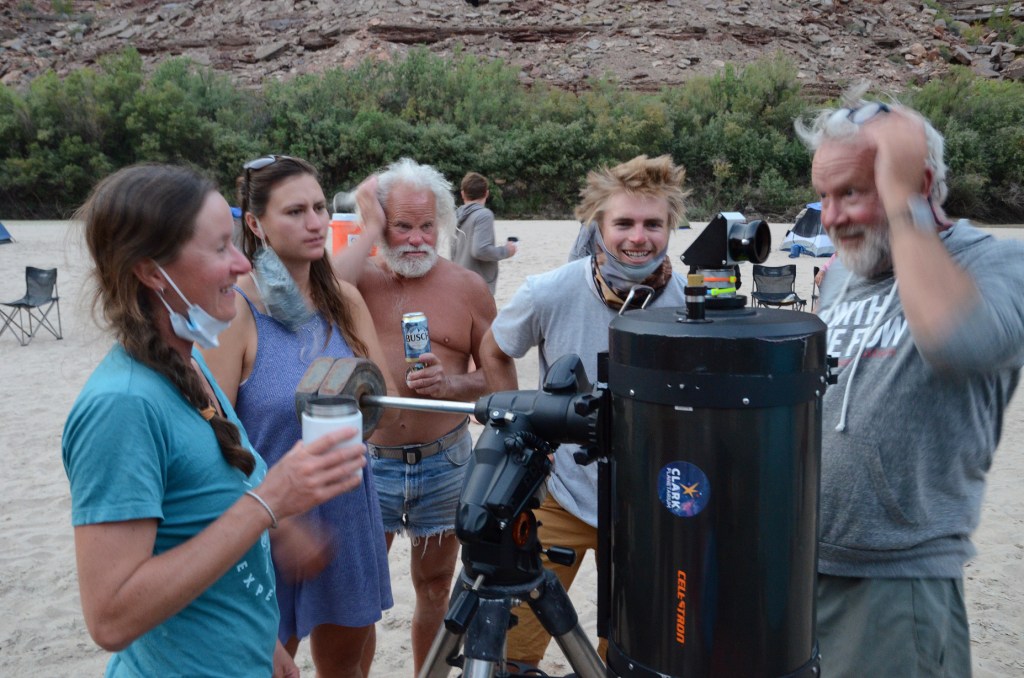
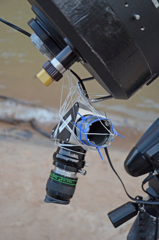
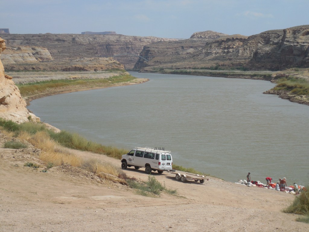
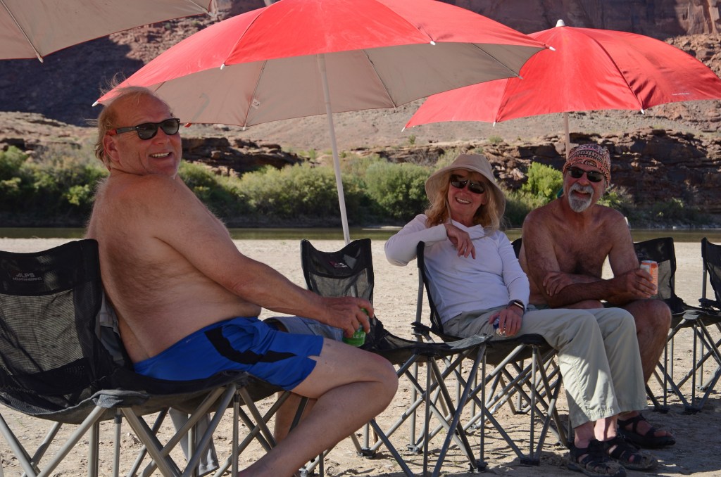
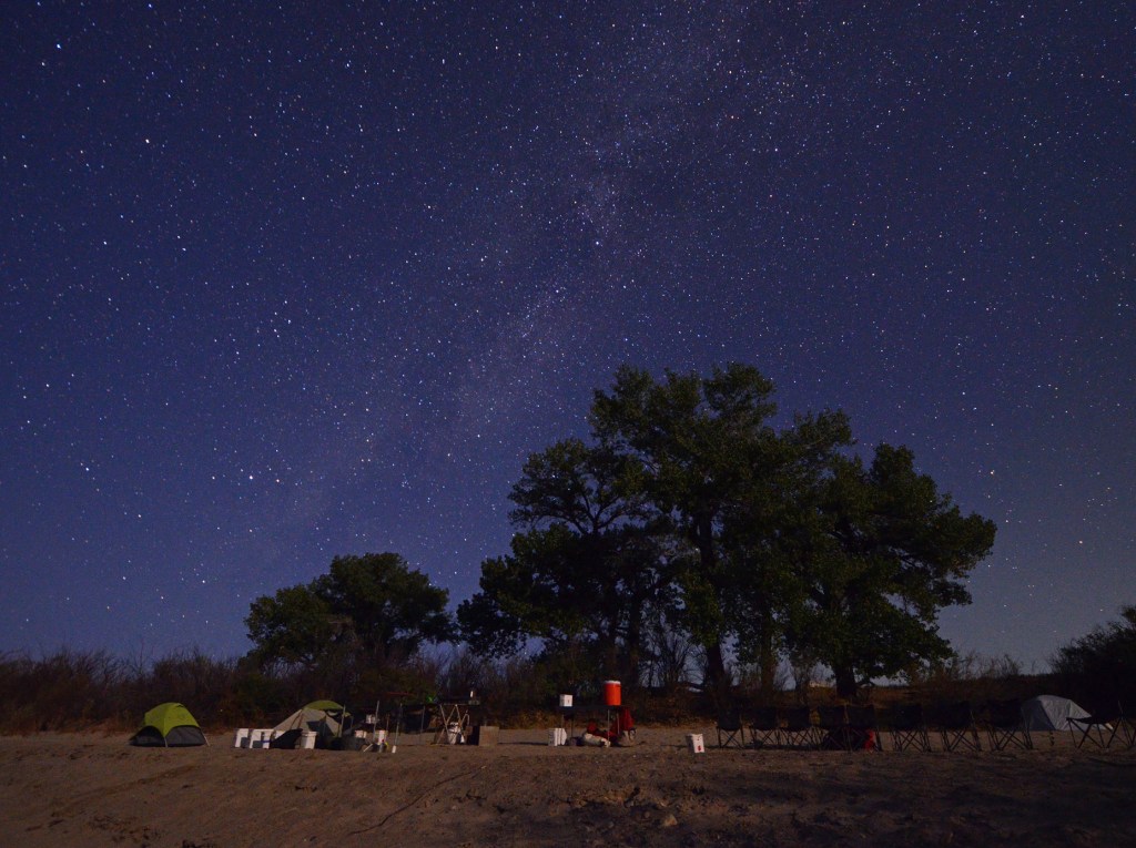
At Mineral Bottom we lost a few of our original Labyrinth team members and picked up about 10 more new crew and clients. Included in this new “team” were a Yoga Instructor (YAY) and an Astronomer (Not so YAY.) The yoga instructor was great – she did short sessions before we jumped into the rafts in the morning and then a very relaxing session in the evenings. The Astronomer was also to be a selling point on this “Stargazing” Trip but it was not to be … he brought the wrong eyepiece for his telescope and several days were spent trying to fix it with toothpicks, duct tape, zip ties and then dental floss. A mechanical failure/computer glitch brought the thing to a screeching halt after a very short star viewing opportunity. Joel summed it up best when he said,” What kind of an astronomer goes to bed at 9:30?”
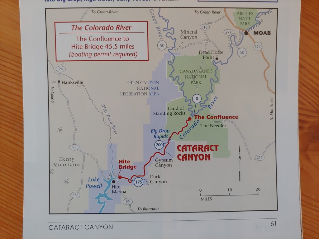
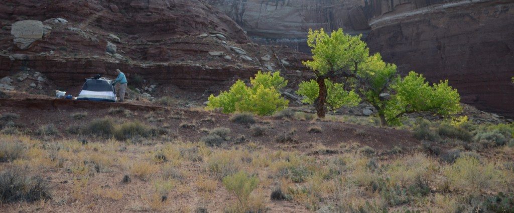
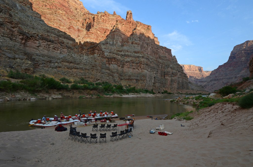
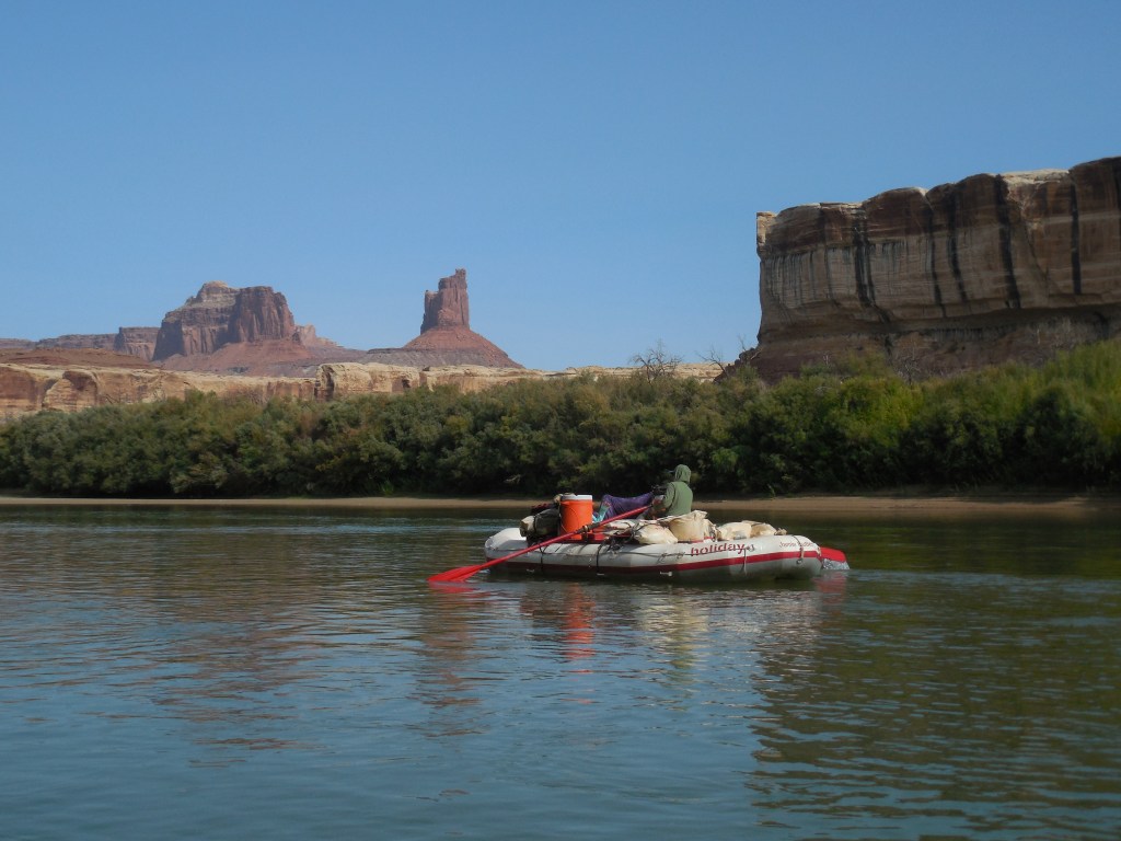
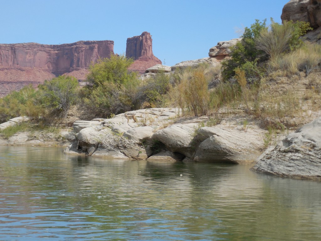
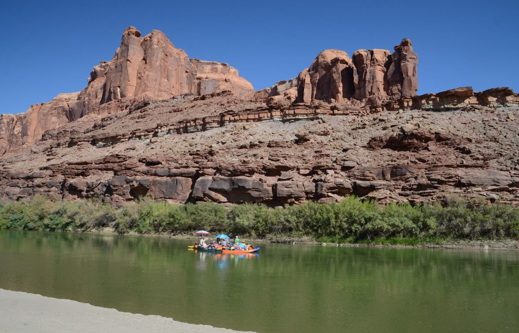
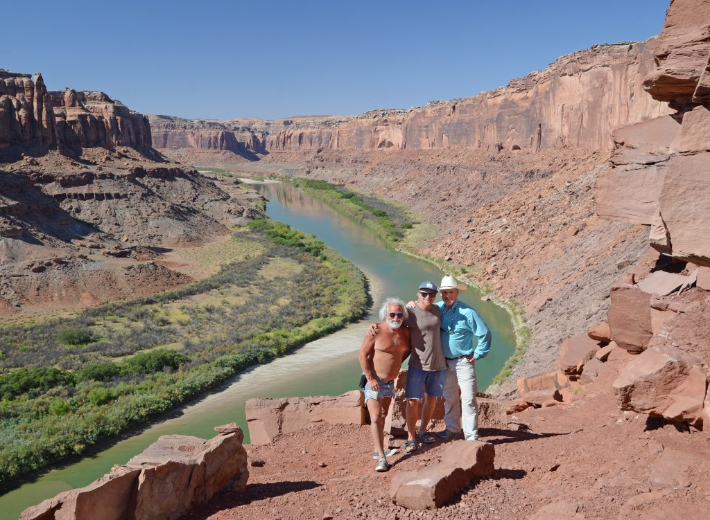
The boat and supply handoff went fairly smooth and after lunch we were off into Stillwater Canyon where we would travel another 34 miles on flat water to the Confluence with the Colorado River. We ended up camping at Hardscrabble Bottom the first night.
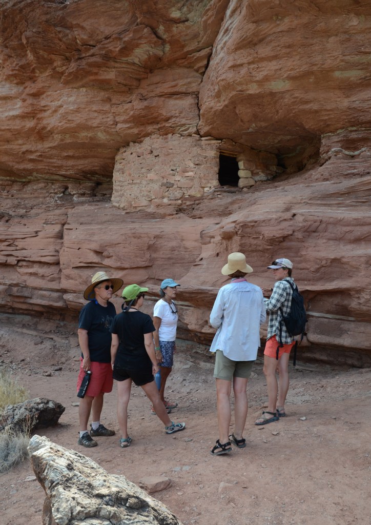
The second day we rafted by Turk’s Head, hiked to the Jasper Canyon/Ruins seeing large dinosaur tracks on the canyon walls on the way. It was a 20-mile day!
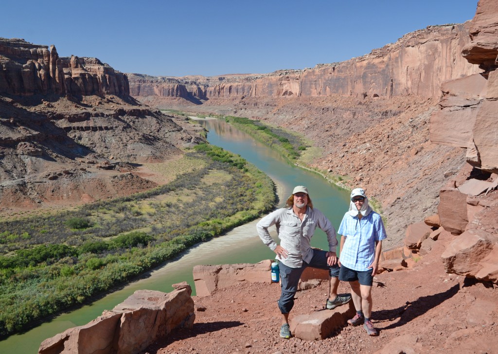
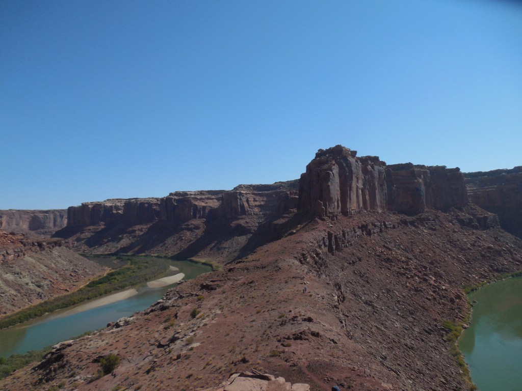
The third day was not quite so long – it was a 15-mile day and we ended up camping about 8 miles from the Confluence with the Colorado River.
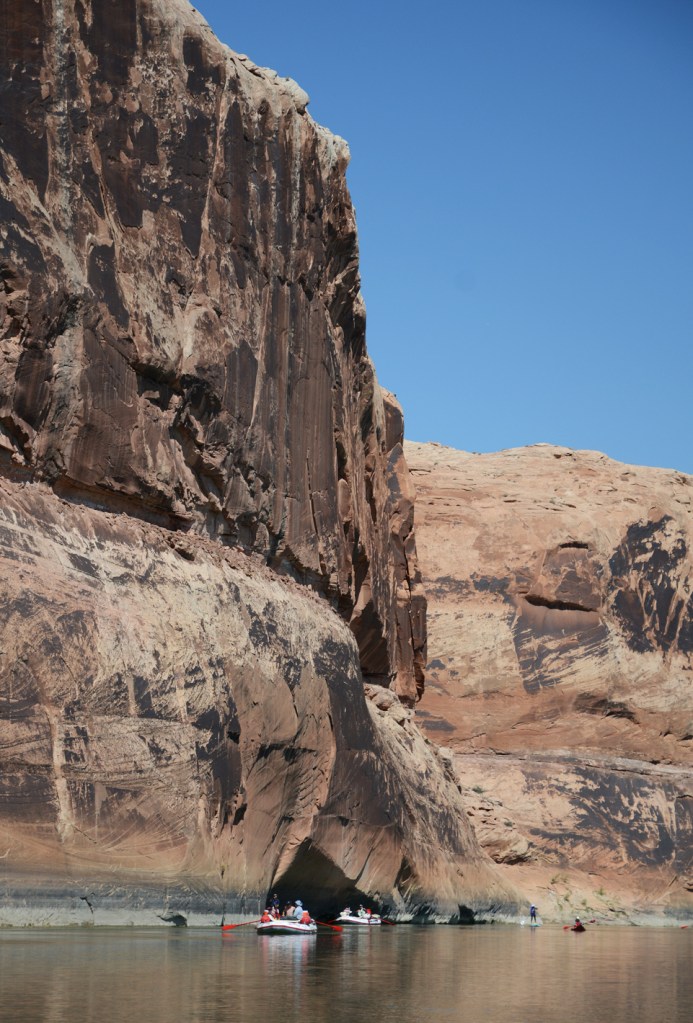
Day four saw us finally out of the paddling and into the Cataract Canyon rapids! We camped at Lower Rapid #15. (Unfortunately, we don’t have any photos of the rapids as the cameras were securely stowed in waterproof containers – next time GoPro!)
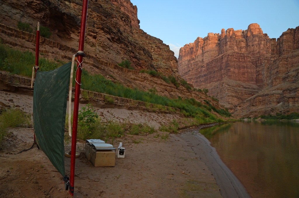
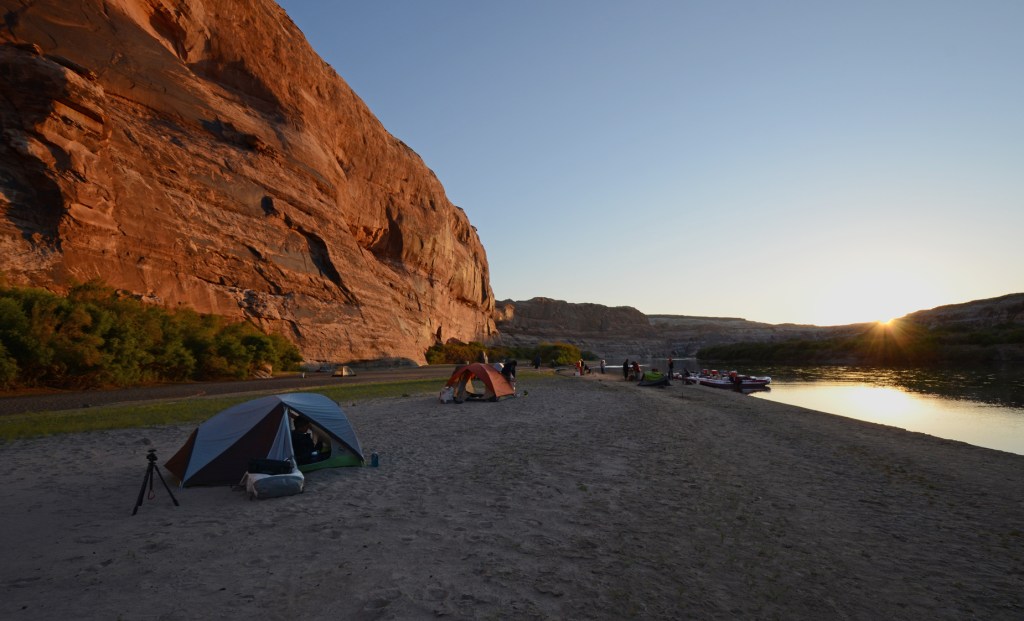
Once through the rapids we took a hike to Imperial Canyon and then spent our night#5 down river and around the bend at Gypsum Canyon.
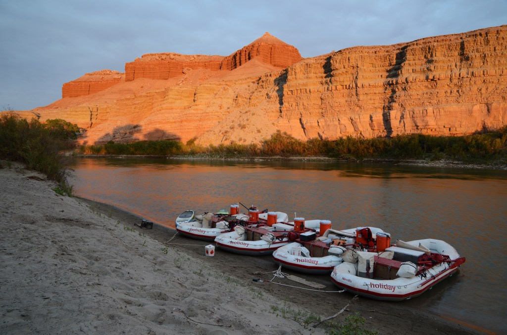
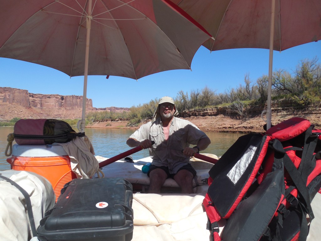
Our last day saw us getting a tow/push the remaining 30ish miles to the Hite Marina as once we hit Lake Powell, the flat water returned again.
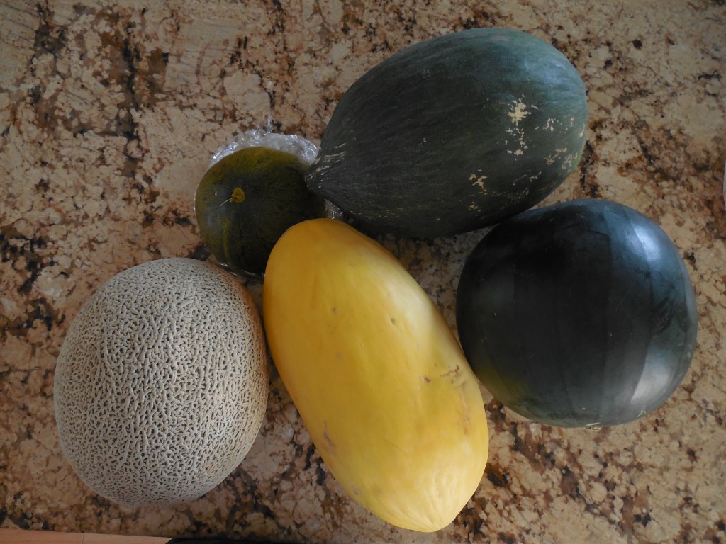
It was sad to leave Green River as after 10 days, I can safely say that both Joel and I were relaxed (no cell phones or electronics) and revived. We did bring home about 30 lbs of the “famous” Green River Melons (Cantaloupe, Seedless Watermelons, Crenshaw, Lambkin and Israeli Melons) that we were treated to every day on the trip. YUM!

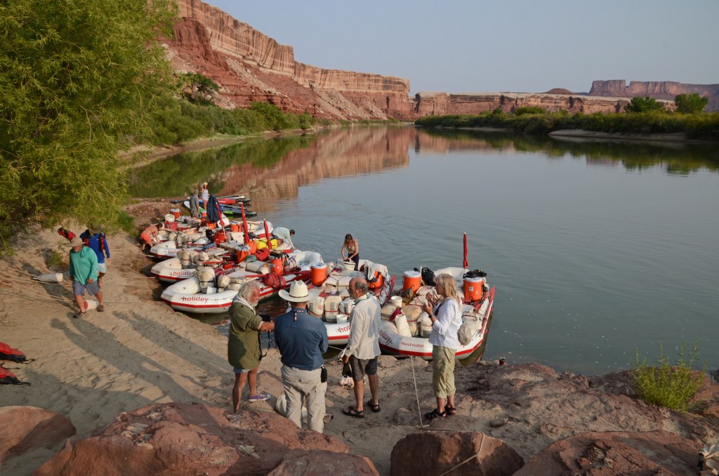
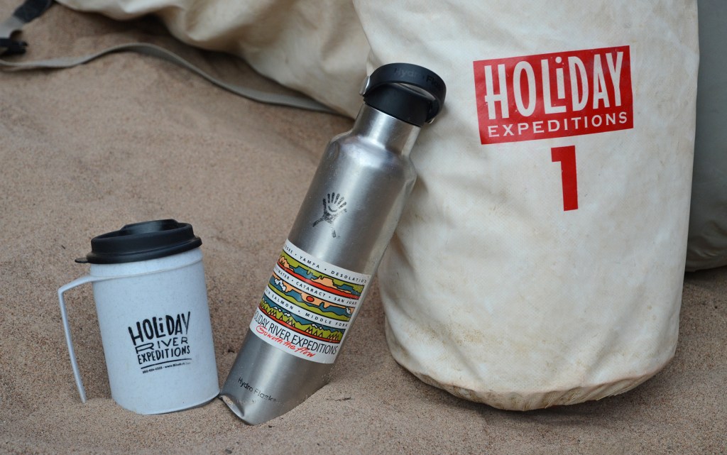
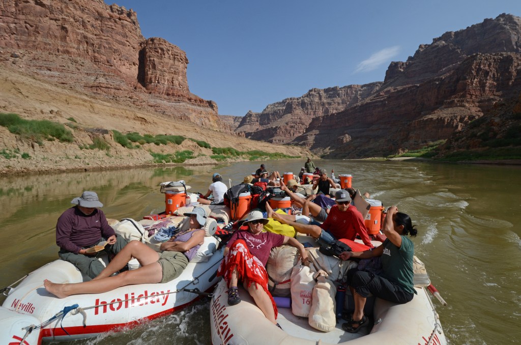
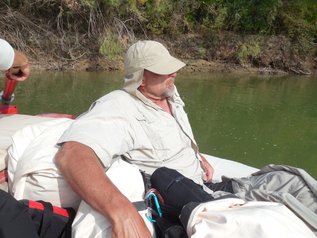

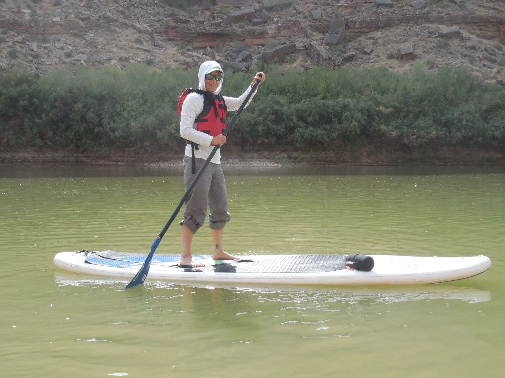
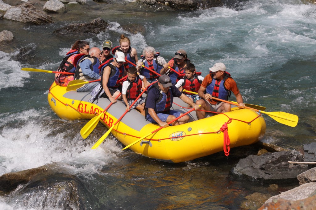
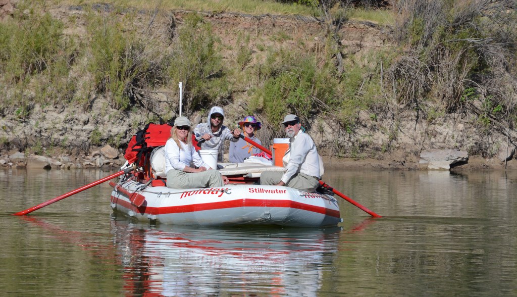
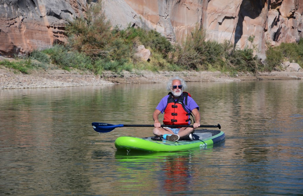
At the suggestion of our friends from WRCNU, Claudia and Ralph, Joel and I signed up for a 10-day river trip on the Green and Colorado Rivers with Holiday River Expeditions. Our only previous river rafting adventure (see photo below) was a short, partial day outing during our family reunion several years ago in Kalispell, MT. That trip was vastly different as the raft was large, seating 10 – 12 people and everyone had paddles. For our trip last week, we had smaller rafts with a guide and 2 – 4 clients and only the guide paddled.
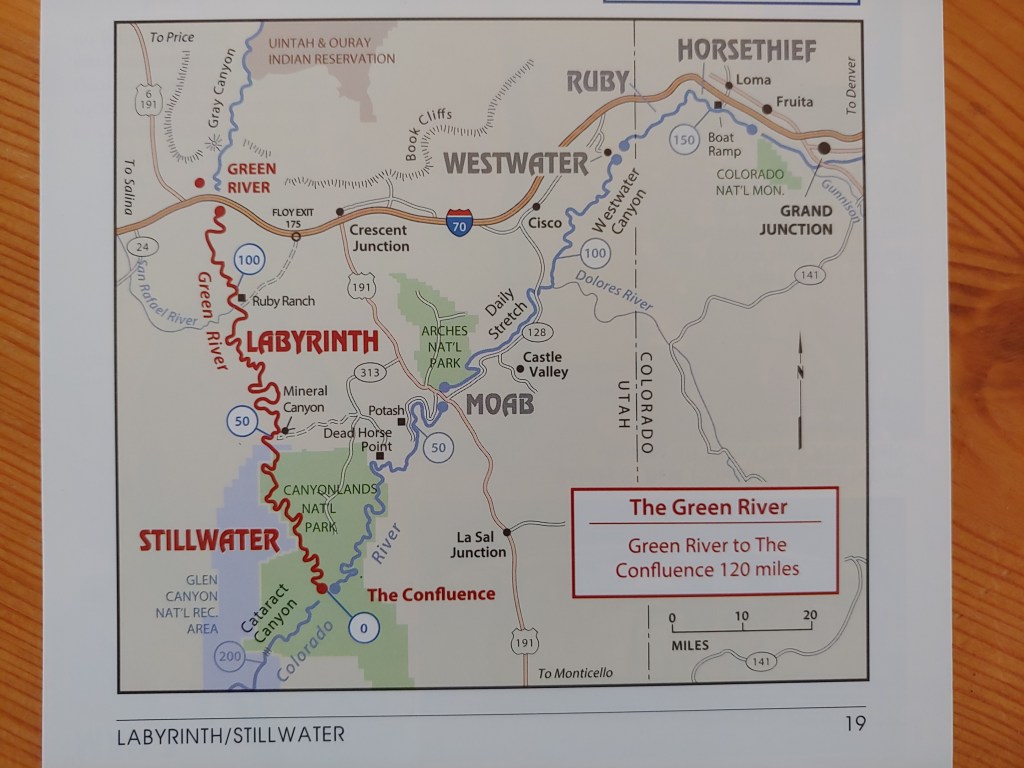
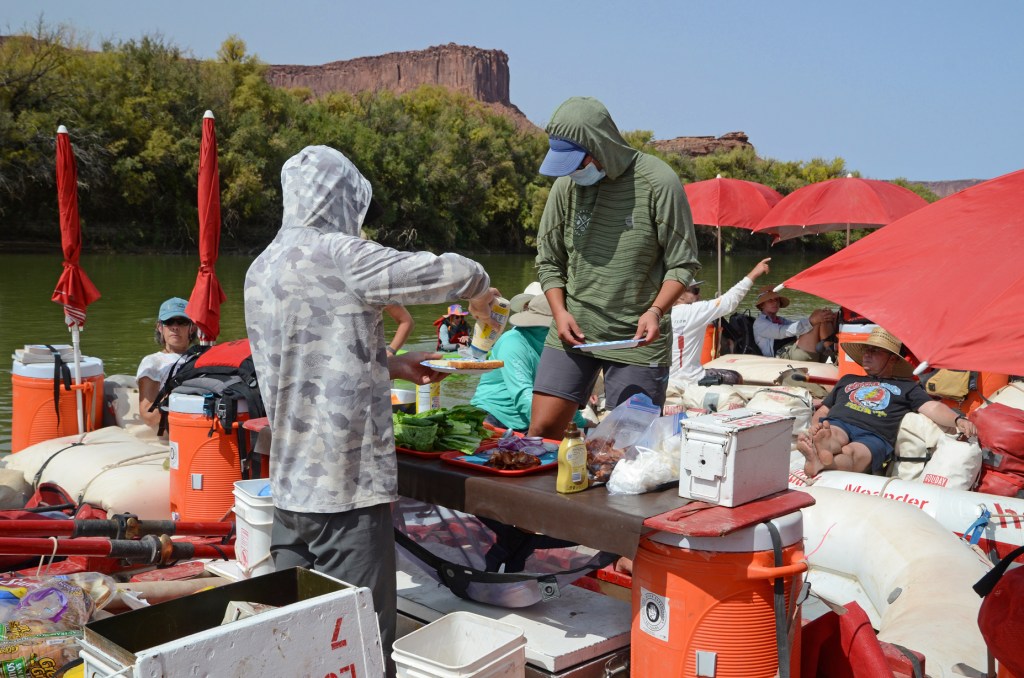
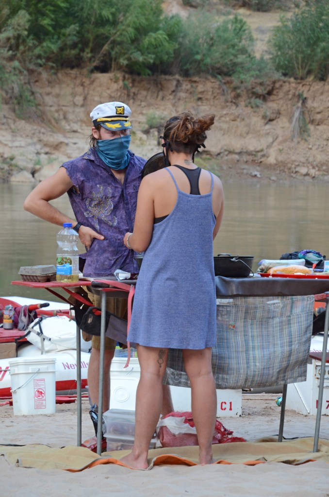
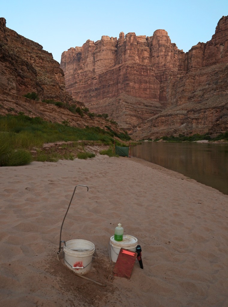
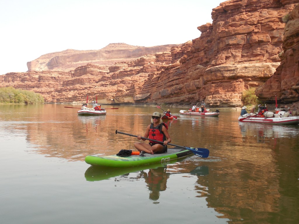
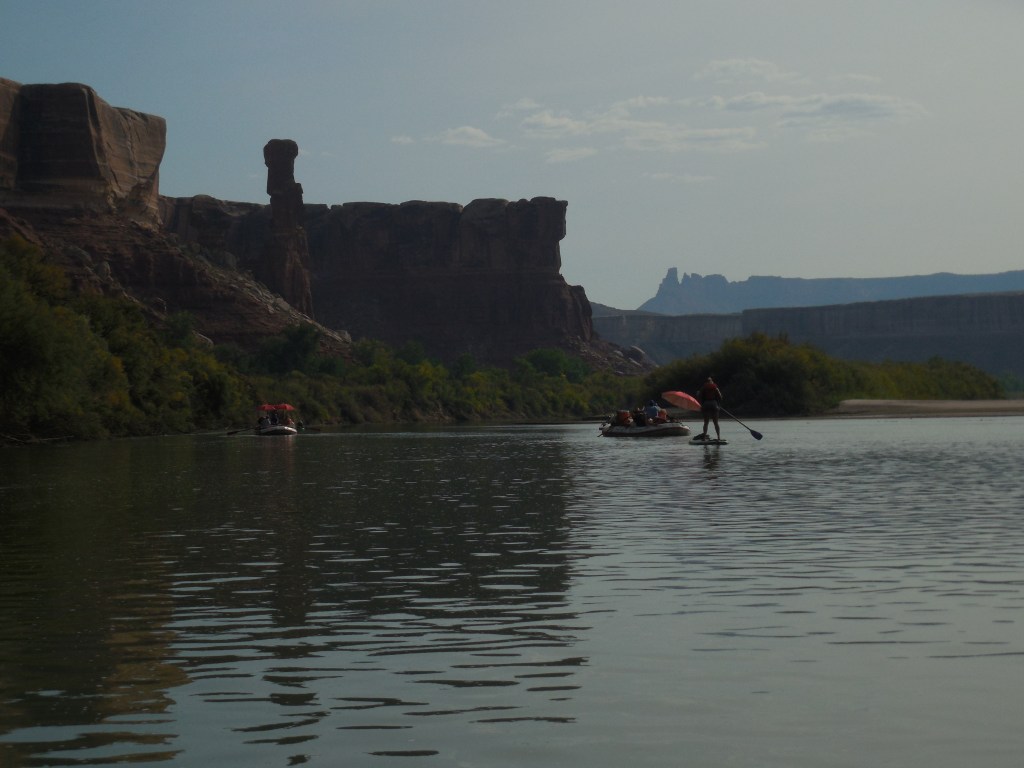
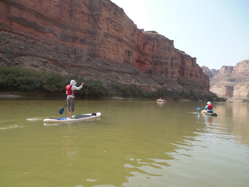
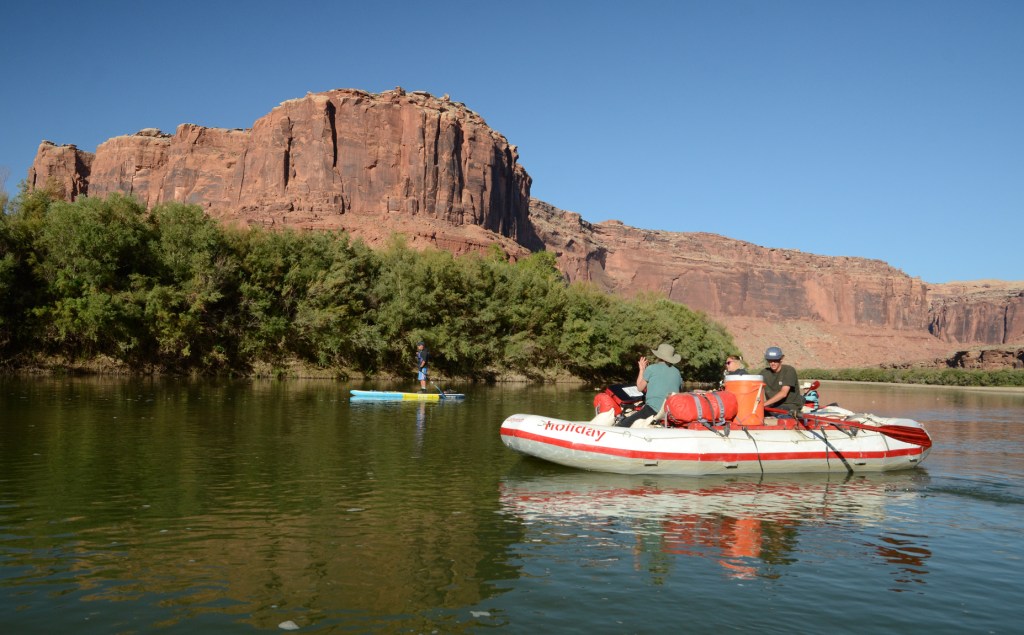
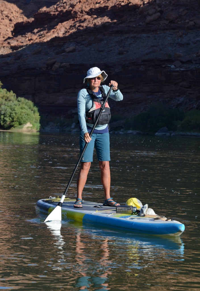
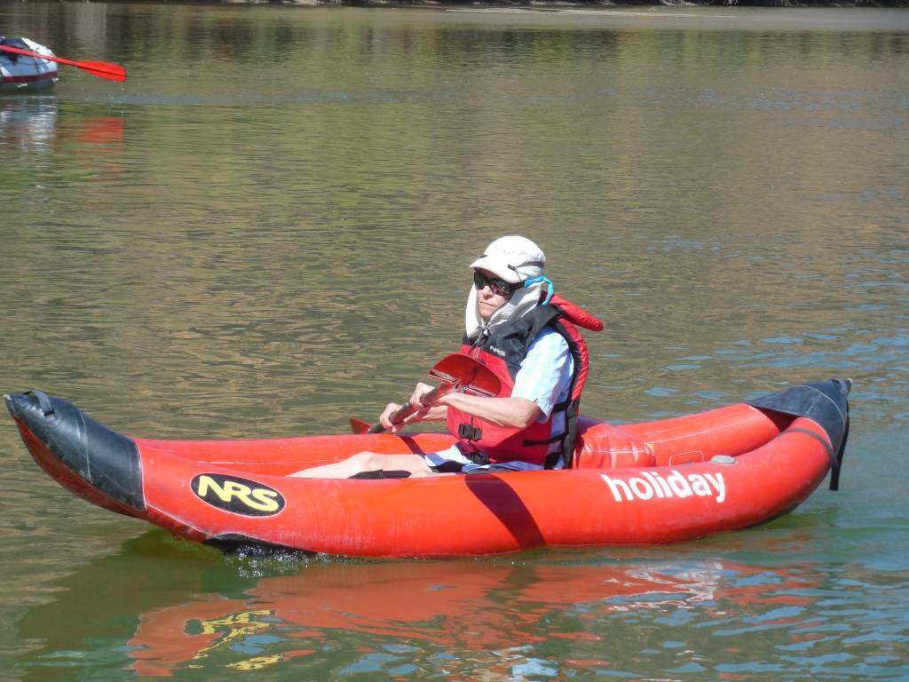
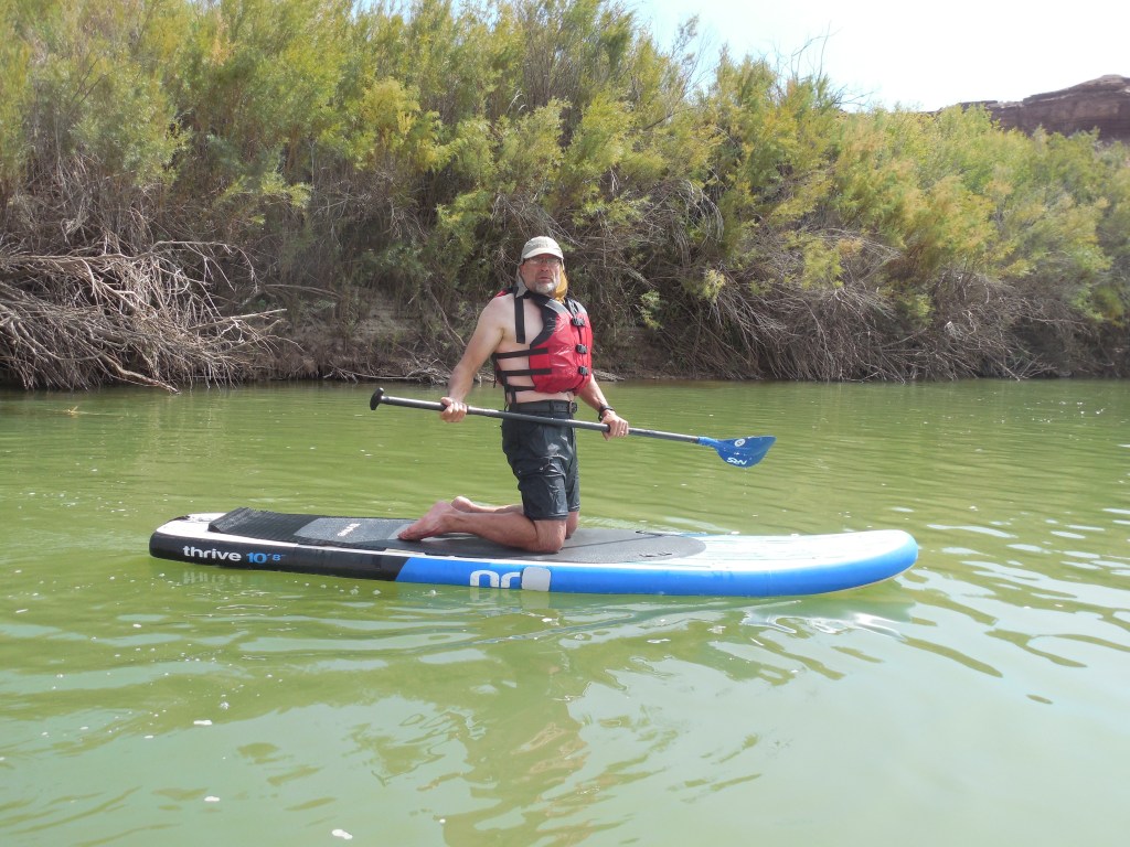
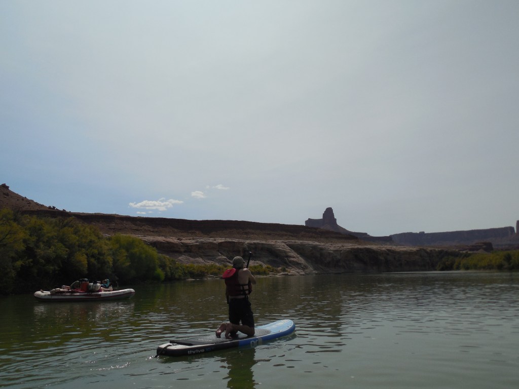
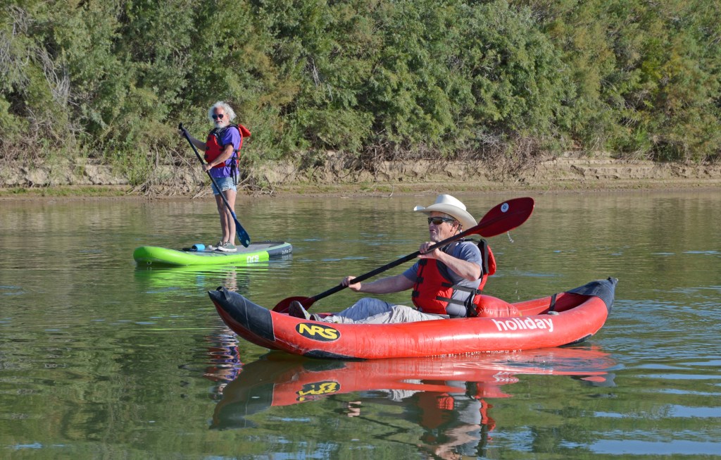
The Green River through Labyrinth Canyon does not have any rapids and due to the low water typical for late season, we were able to take advantage of the Stand-Up Paddleboards and inflatable canoe they brought along. Sadly, for the guides, they had to paddle the entire length of this section of the trip (68 miles.) Plus they were up at 5:30am making coffee and breakfast, fed us amazing lunches and dinners complete with appetizers and then after clean-up, they got to stop working around 9:00pm. Huge effort on their part and we were duly impressed!
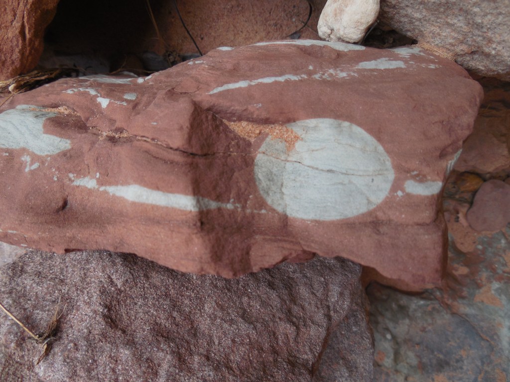
There were ancient cultural sites to enjoy as well as evidence of historical markers made by some of the early river runners. Our group was relatively small and consisted of several family members of the guides so it was a fairly close-knit group.
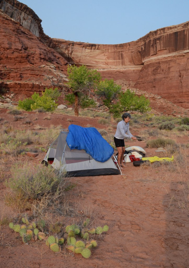
The first day we met at the Holiday River Expeditions office in Green River, UT. We took a very short, 5 minute, drive to the launch site at the Green River State Park and were on our way. En route to our campsite at Anvil Bottom we took a short hike to see some petroglyphs and visited Crystal Geyser. Our “mileage” this day was 18 miles.
The second day we entered Labyrinth Canyon and had lunch at Trin-Alcove and ended up camping near June’s Bottom for a total of 14 miles.
The third day saw us visiting the inscription of French Trapper Denis Julien and we camped across from the “Launch Marguerite” inscription after a journey of 15 miles.
Our last day for this segment of the trip traveled through Bowknot Bend to Mineral Bottom where we met our new “team” members for the second section – Cataract Canyon on the Colorado River. Along the way we had a nice hike up to the saddle of Bowknot Bend where we again saw inscriptions from previous travelers and had a great view of the river on either side.

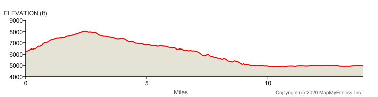
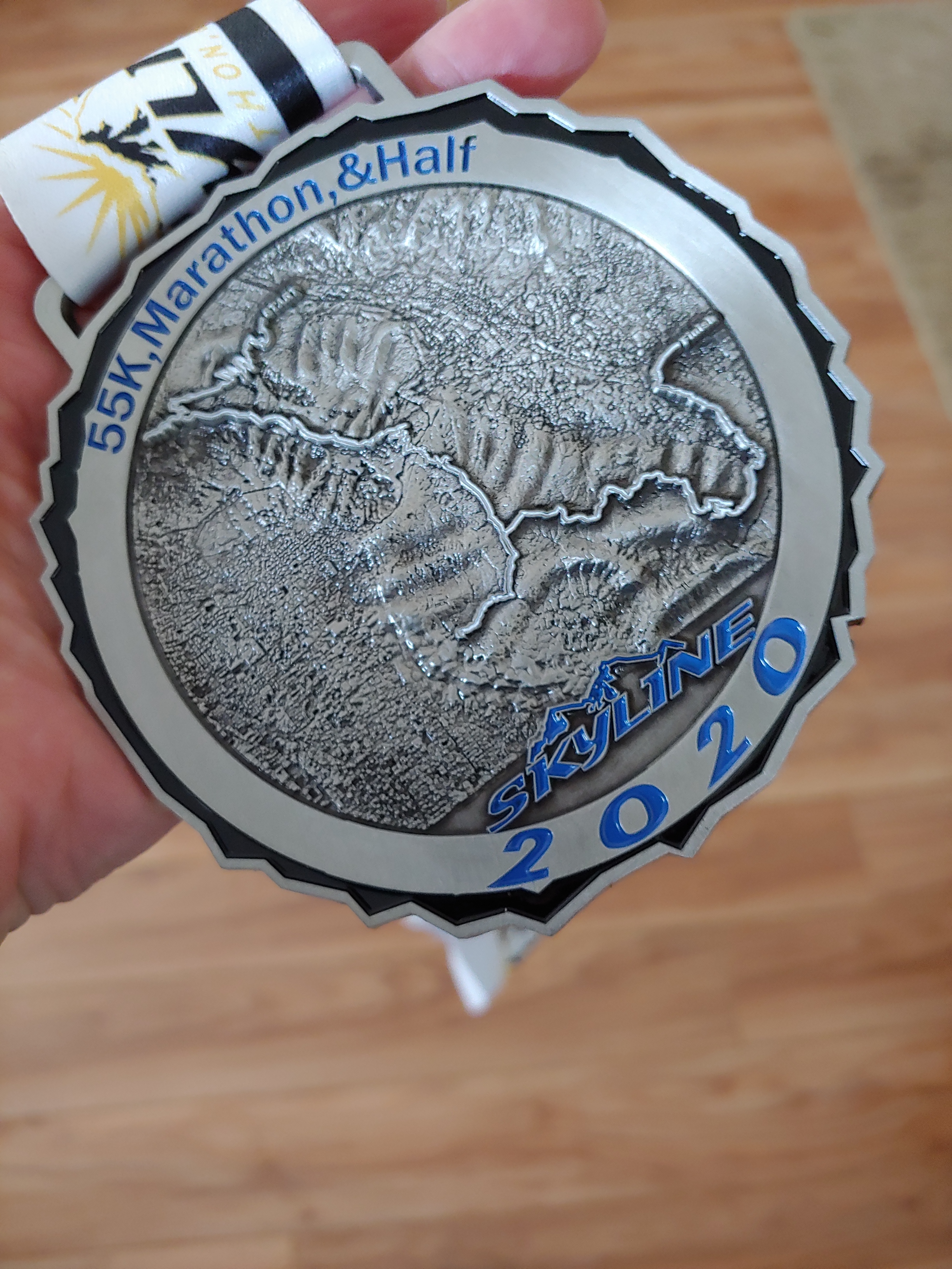
“Described by its race organizers as “punishing, unforgiving,” and yet “ridiculously beautiful,” this race is all that and more — with some 1,900 feet of elevation climb in just the first three miles of the half marathon route, every runner who dares to tackle the trails that wind up the mountains overlooking the Eden Valley below will experience those and everything in between.
The race takes runners along what is known as the Ben Lemond and the Skyline trails, which climb up the mountains here in the northernmost part of Utah through a series of switchbacks, twisting and turning along the dirt trails within the Cache National Forest, looking out onto Salt Lake City to the south and the mountains of southern Idaho to the north.
It’s not hard to figure out why it takes a special kind of runner to attempt this race when you consider that, aside from water stations, there’s none of the amenities at the Skyline Mountain races that runners are accustomed to having at other races — no cheerleading spectators, no rock bands, no blocked-off roads. It’s just runners and the trail, and tough trails at that.
Runners in the half marathon begin their race at the area known as the North Ogden Divide, which also is the mid-way point of the full marathon, just off North Ogden Canyon Road.
From there, they follow the South Skyline Trail as it winds its way southward through the mountains, climbing nearly 1,900 feet from the start to the half marathon’s peak elevation of just over 8,000 feet, which occurs just before runners reach the mile 3 marker.
From that point, the race follows a long and very gradual downhill descent over the next several miles, offering up some of this area’s most spectaular scenery from a vantage point few get to see.
The course keeps heading downhill until runners reach the part of the trail that runs along the shoreline of Pineview Reservoir, where it flattens out and remains flat for the next few miles, as they head into Eden for the race finish.
The half marathon in this race is what the organizers call a “half marathon +1,” meaning that it is actually 14.1 miles rather than 13.1 miles.”
————————————————————–
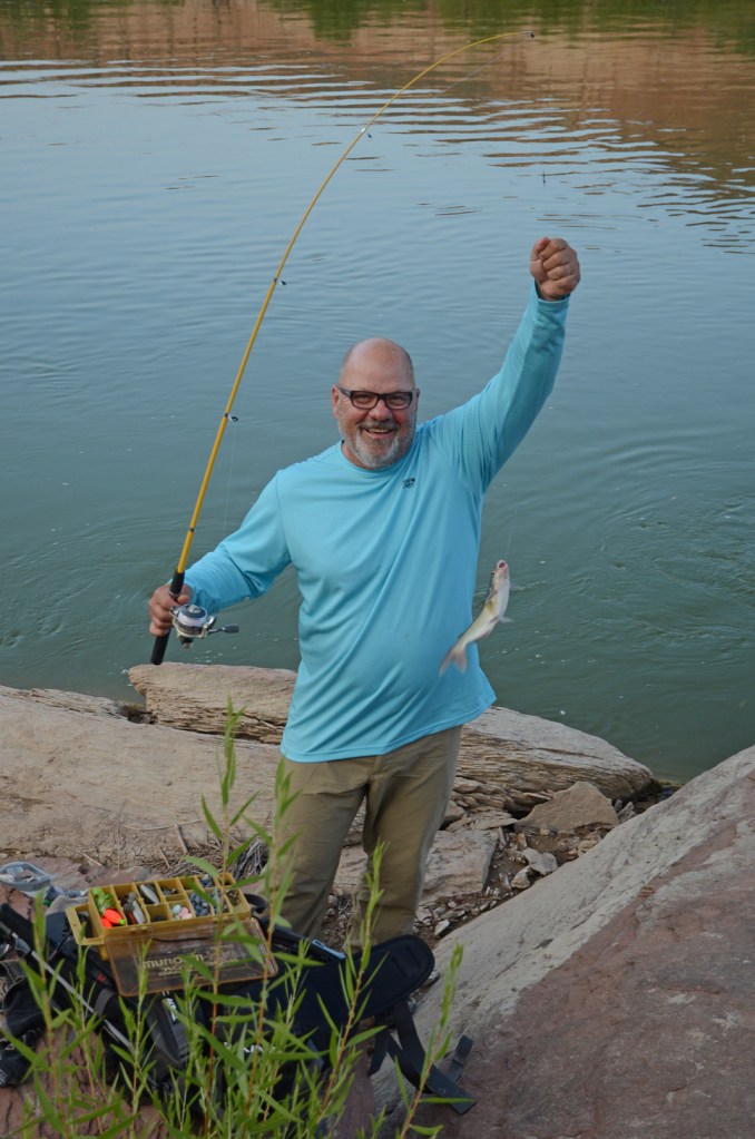
Finished about 9 minutes slower than last year. Sort of a “blah” performance – thought I was doing OK as I was 4 minutes faster than last year at the last aid station but the last 4 miles saw me doing a bit of walking.
The whole event was dialed back this year but kudos to the organizers for making it happen!
Didn’t really spend as much time training as last year plus the trail was closed for almost 1.5 months due to road construction. Many excuses! But sights set for a new PR in 2021!
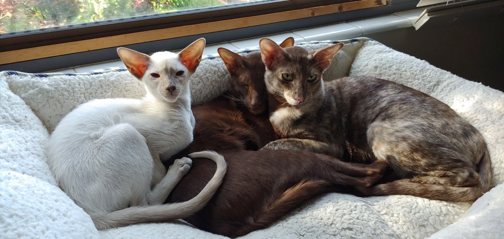
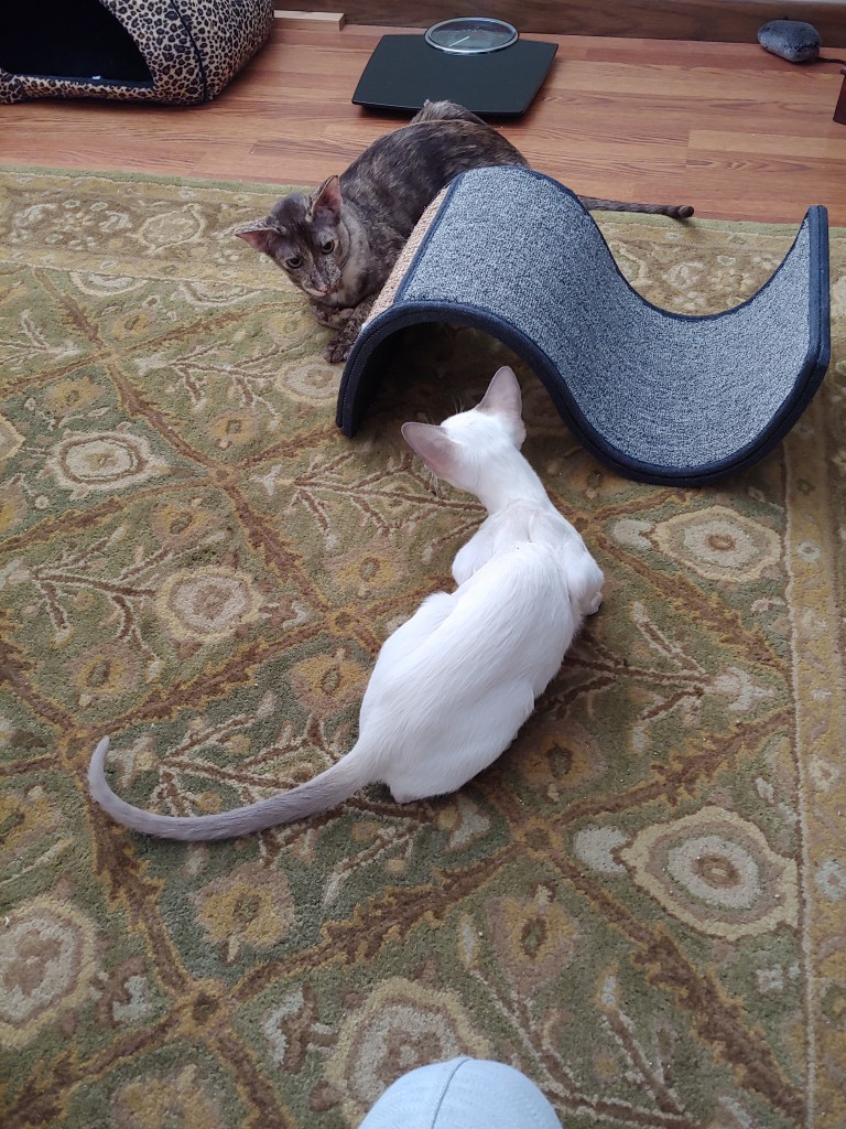
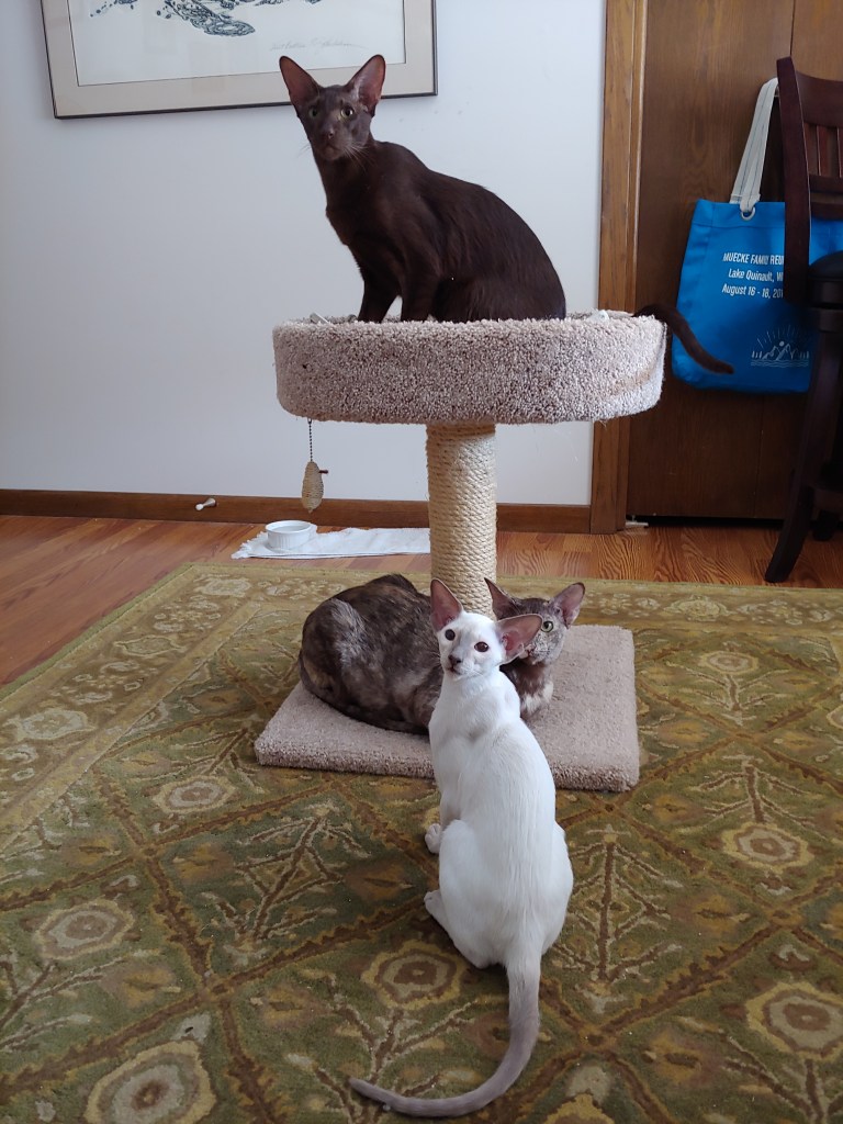
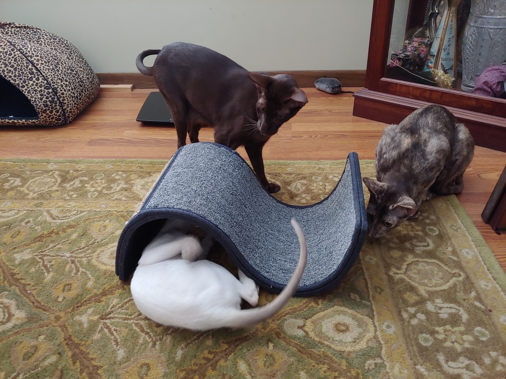
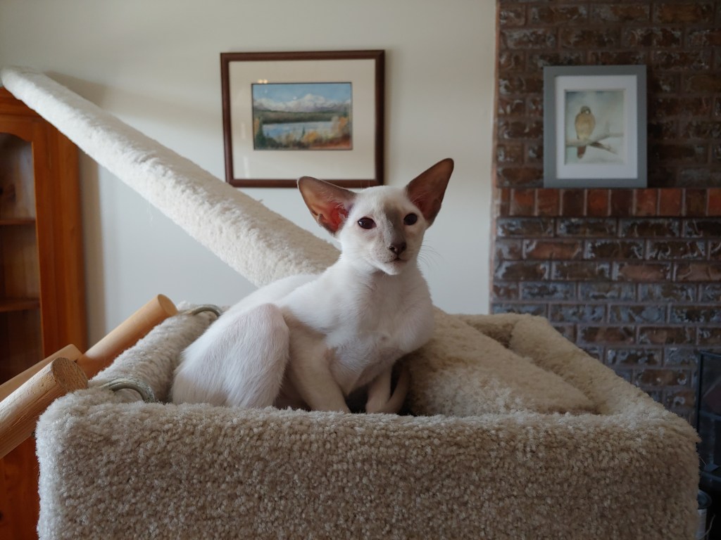
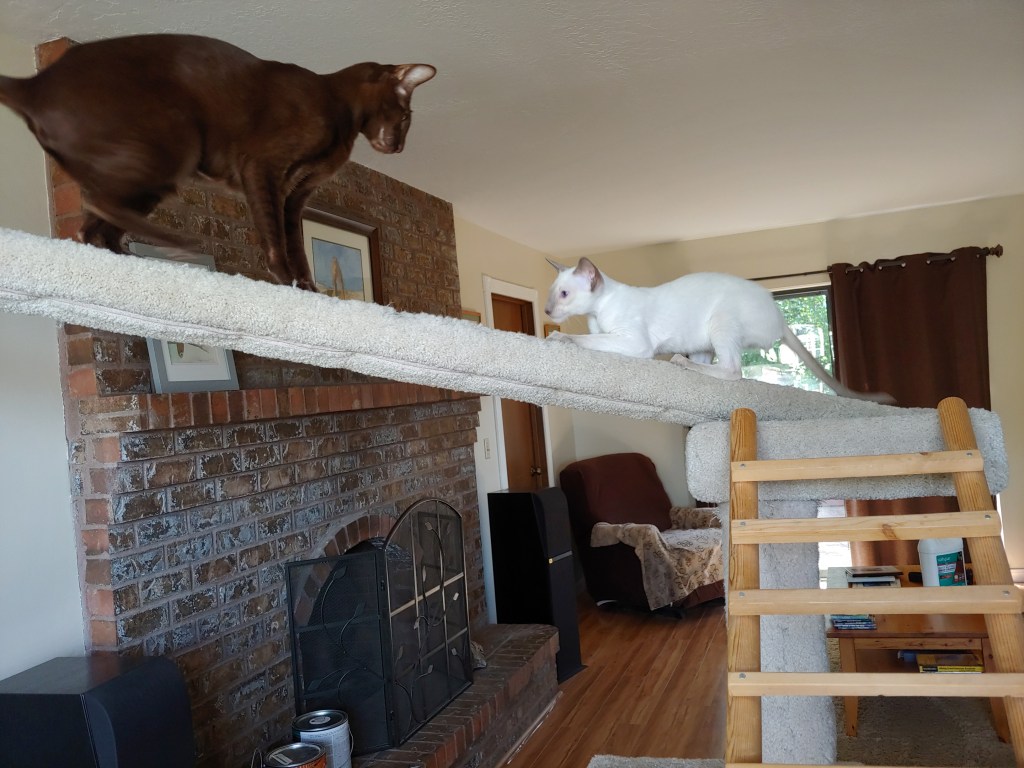
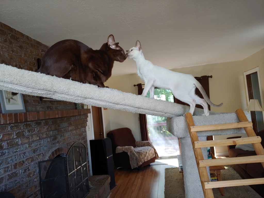
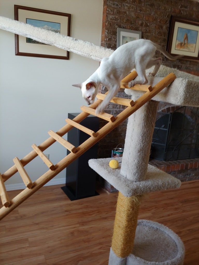
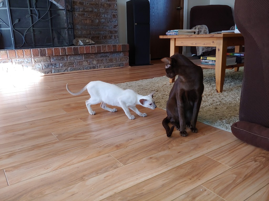
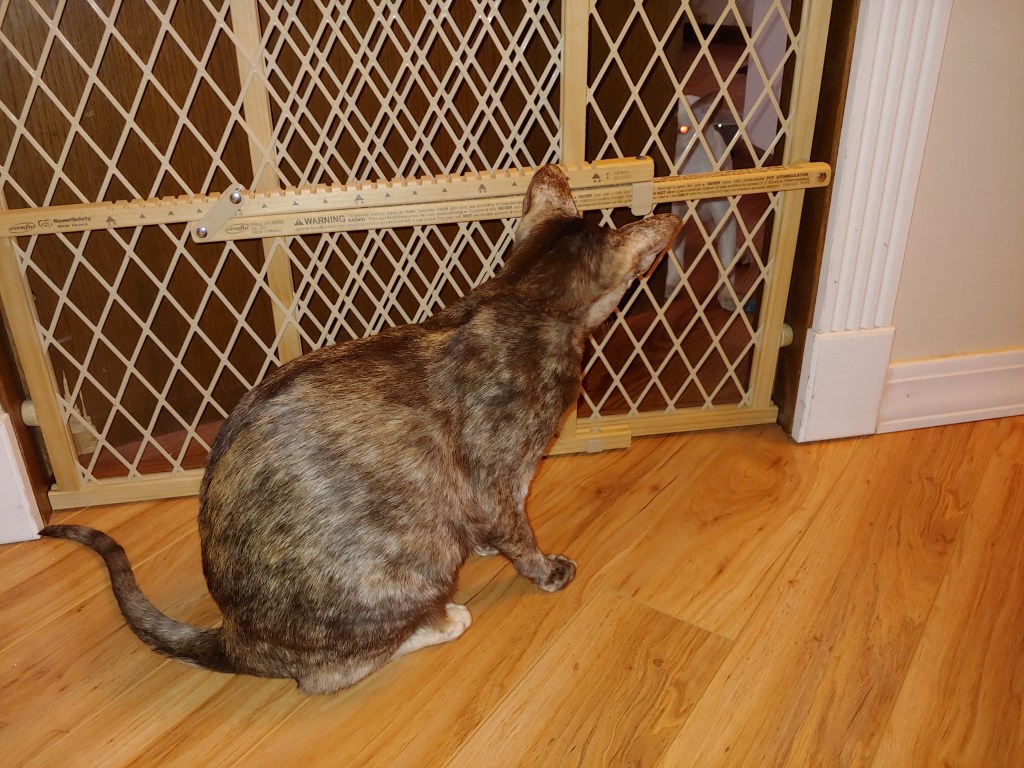
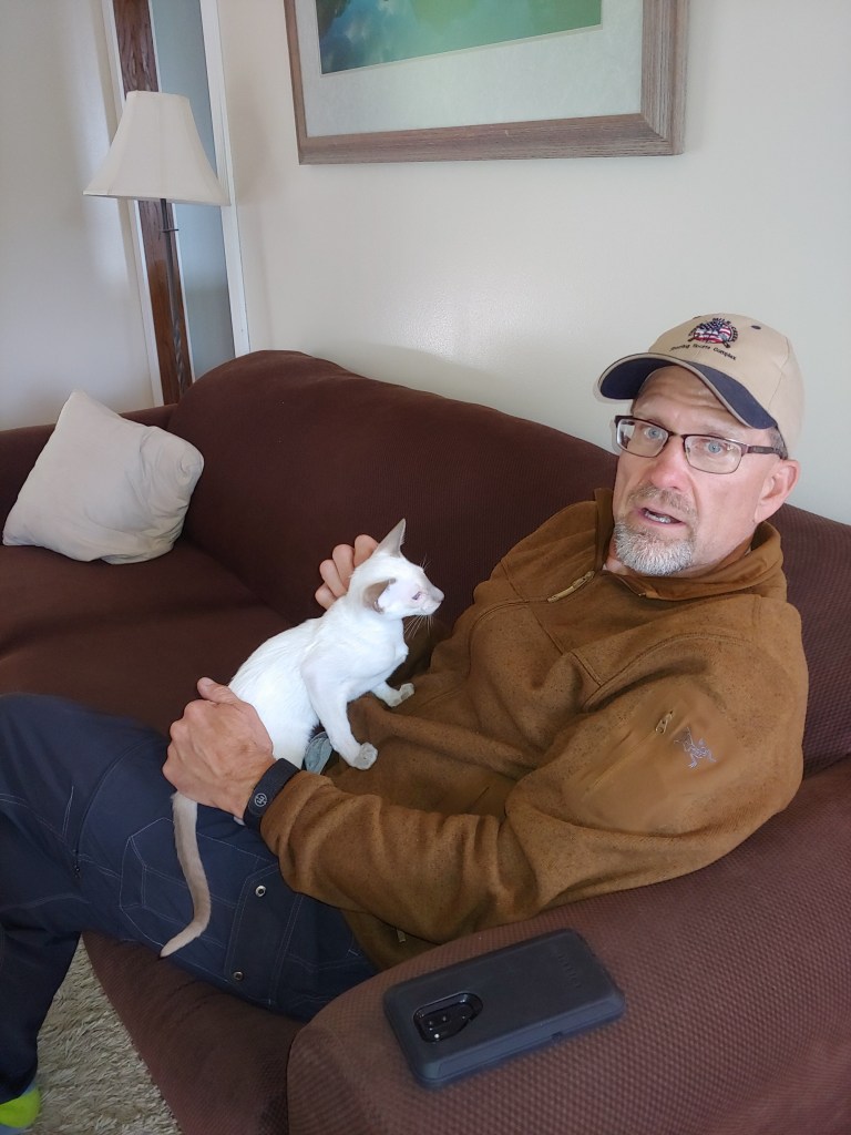
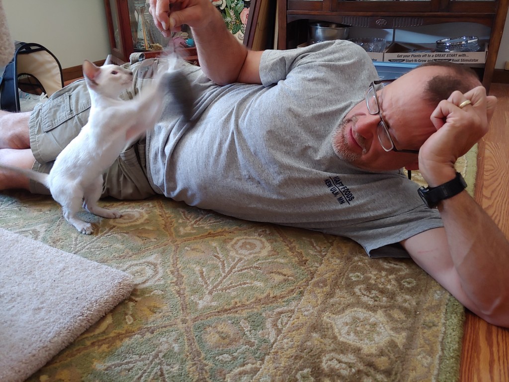
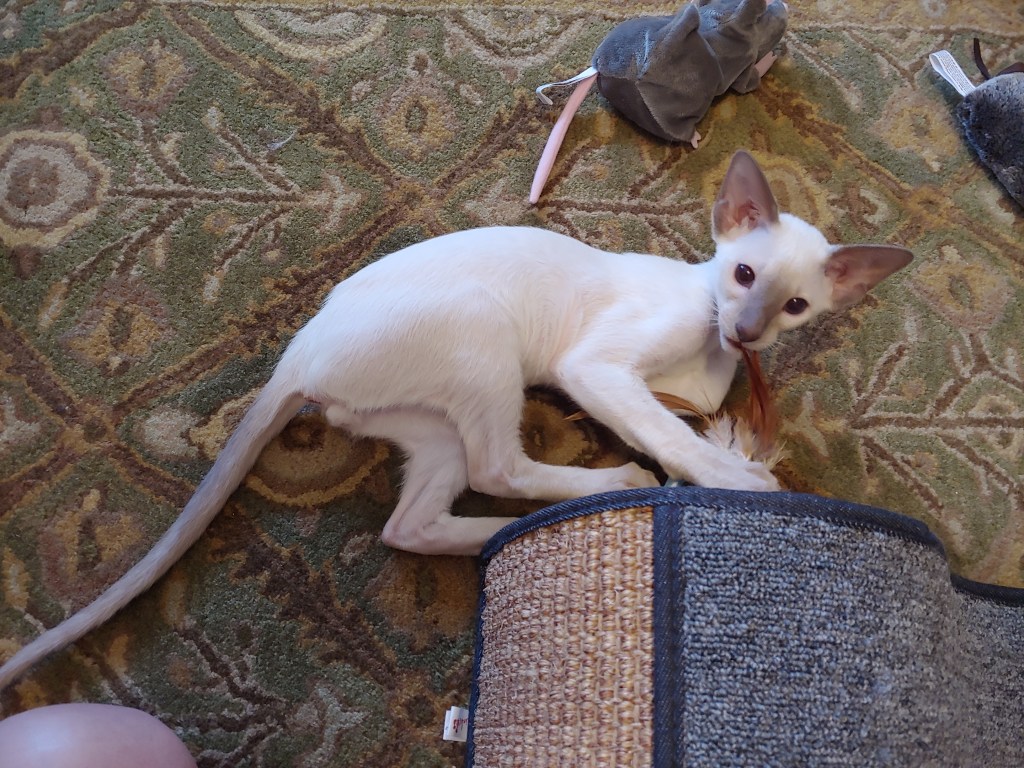
Fast Eddie (“Eddie” for short!) is a Lilac Point Siamese. He is about 17 weeks old in the most recent photos. Introductions with Bruno and Miya just happened a couple of days ago. Many hisses, growls and head bashes initially but hopefully things will settle down fairly quickly!

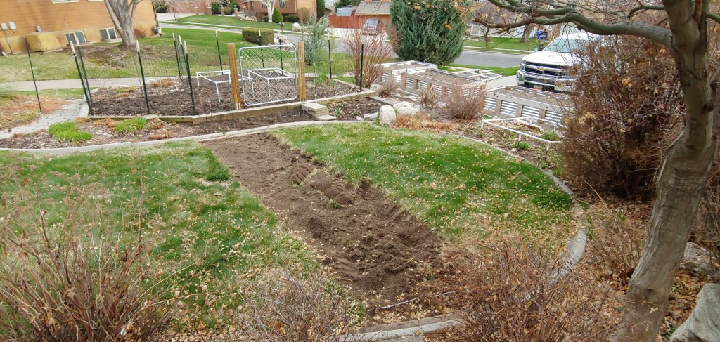
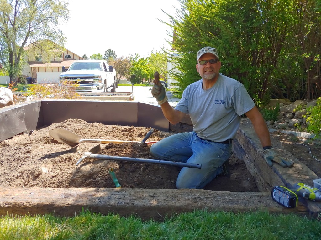
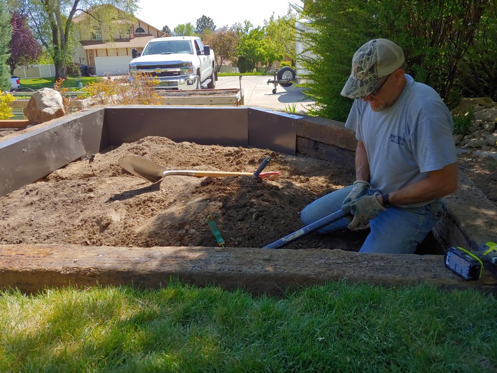
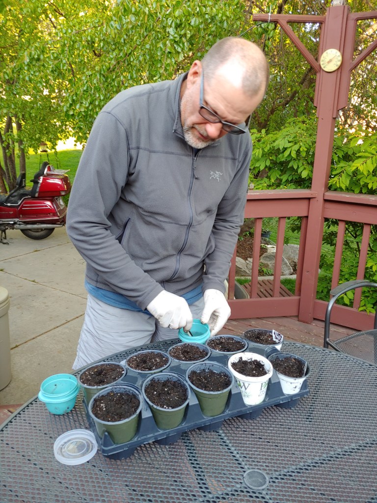
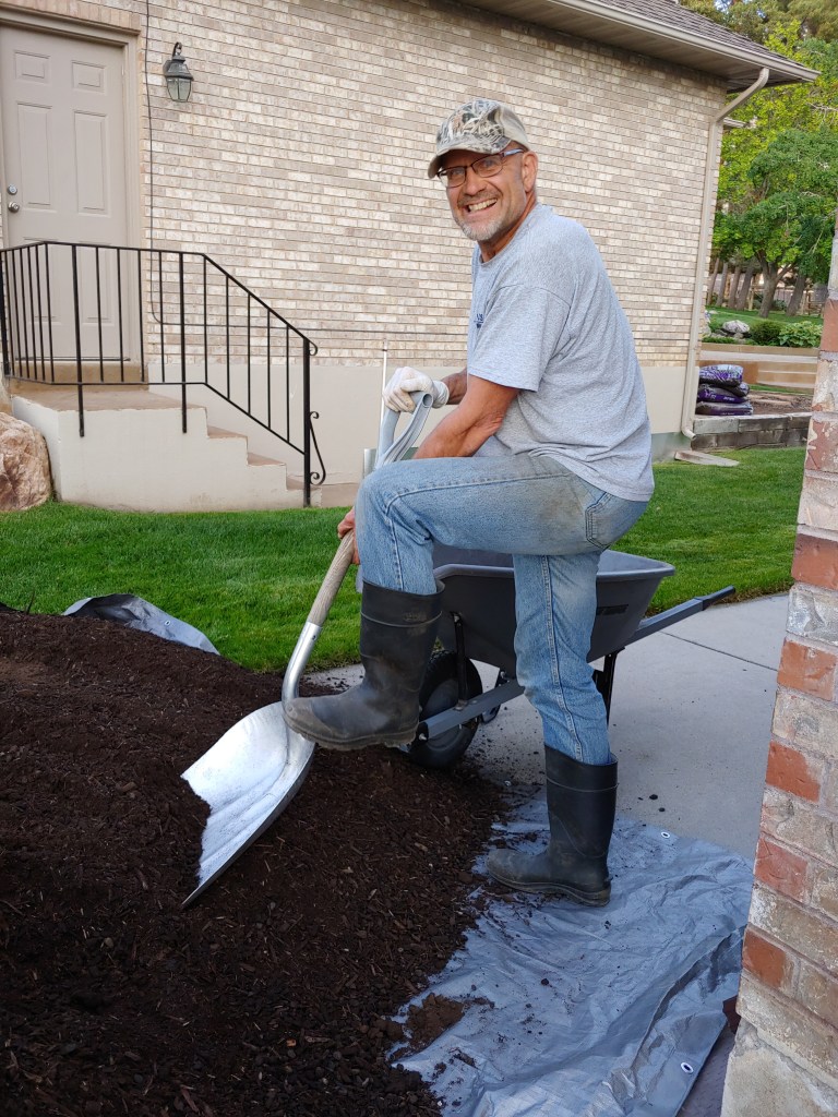
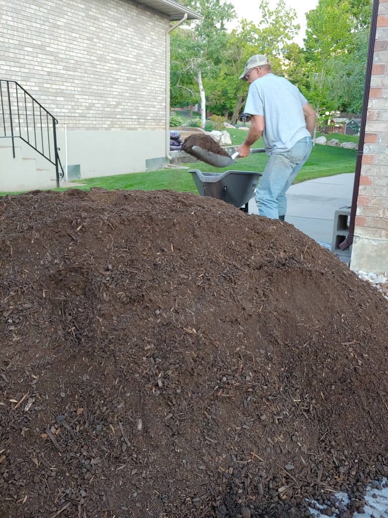
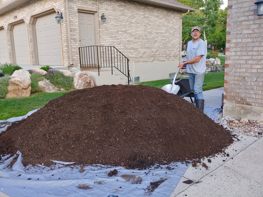
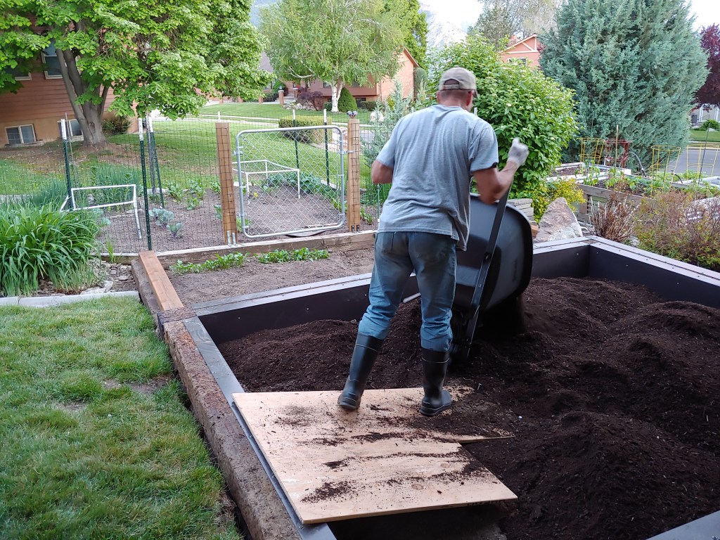
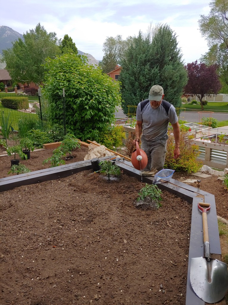
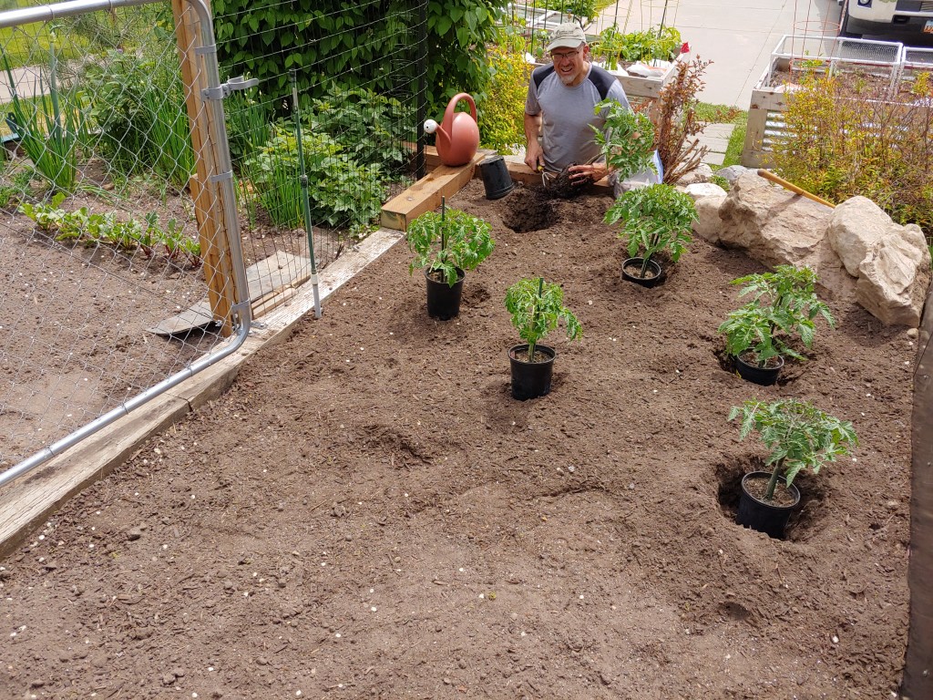
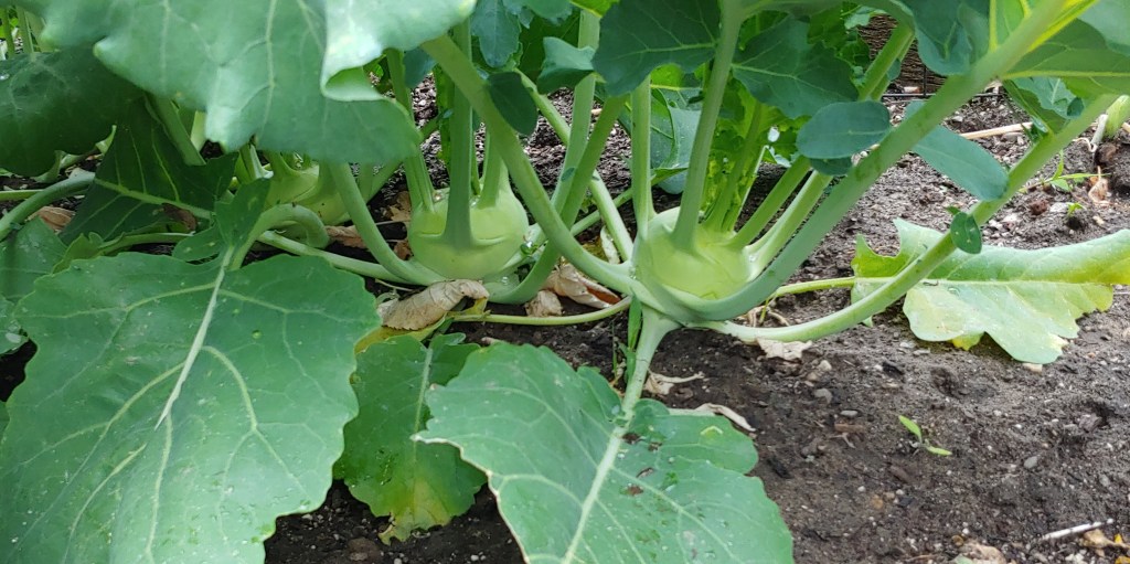
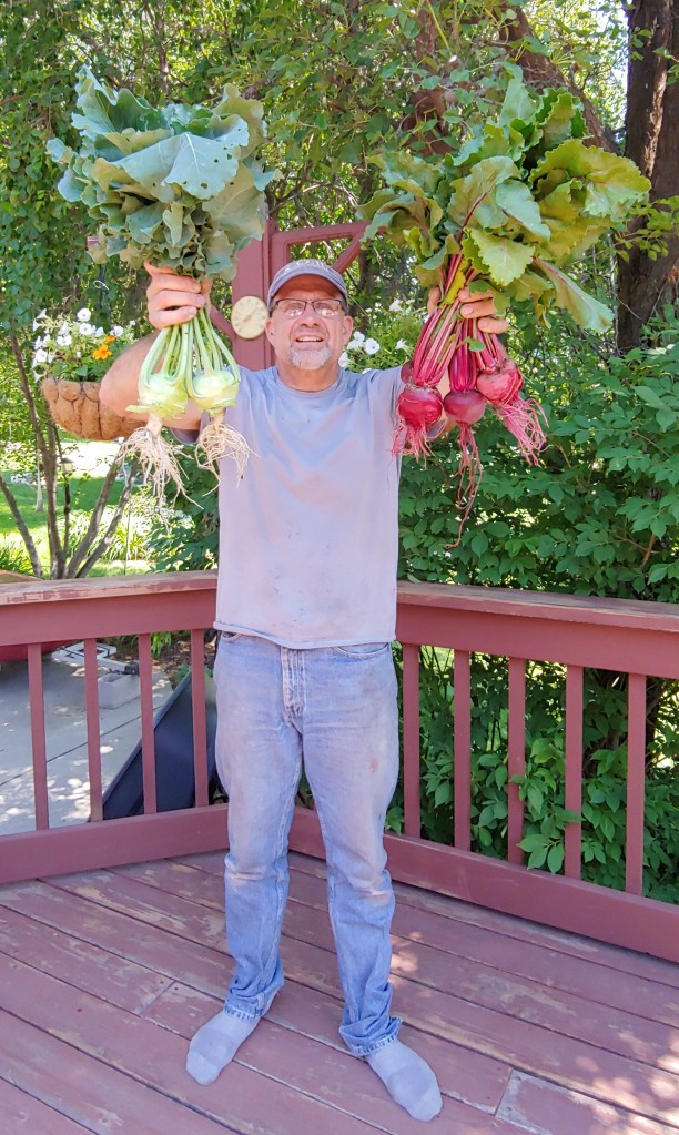
Joel has been planning, measuring, digging, removing sod, placing borders and new soil and adding starts and seeds to his new, expanded garden for many months. The total square footage of the new addition is close to 200 sq. ft.
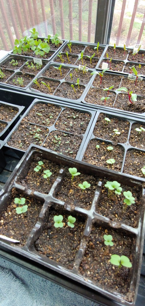
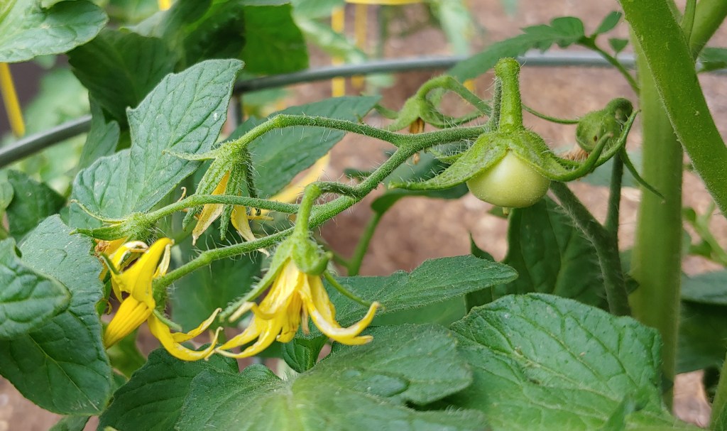
Home improvement projects always seem to take on a mind of their own with multiple, unplanned trips to the local big box and garden supply stores. Hopefully we can breathe a collective sigh of relief as it seems the pests are under control (with netting) and the low temperatures have passed. The first tomato has popped out and we have enjoyed arugula, kale, spinach, chard, beets and several of the herbs.
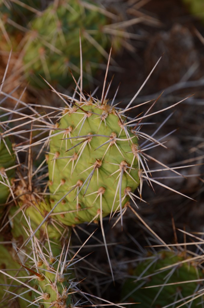
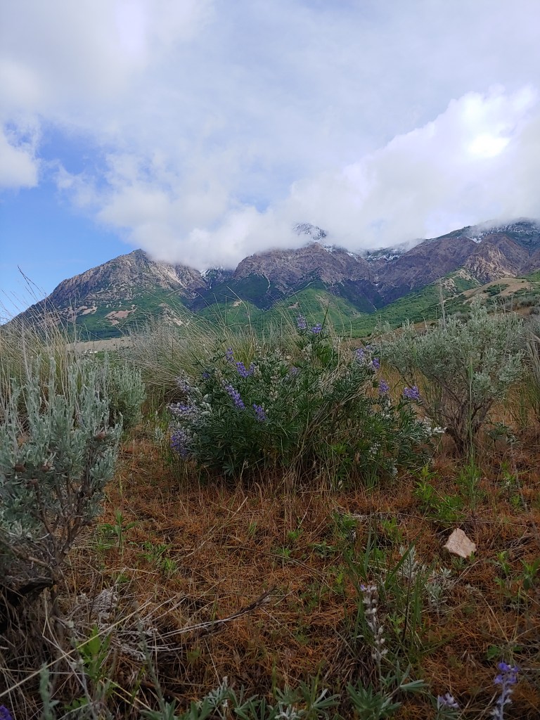
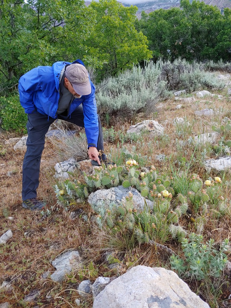
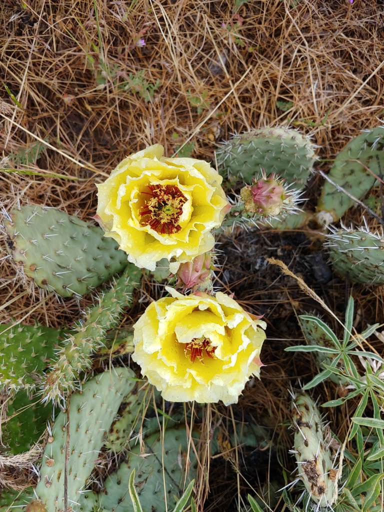
As we move from Spring to Summer in Utah, unpredictable weather seems to be the norm. Within the last two weeks we saw mid 90’s that then dropped down to the upper 30’s and a little bit of everything in between. We took a walk one morning on the Bonneville Shoreline Trail after one such drastic temperature drop with snow visible on Ben Lomond down to under 7,500′ and cactus blooming below on the trail.
A little hard to see but the poor bee in the 4th photo got frozen in place inside the cactus bloom (top bloom in the photo.)
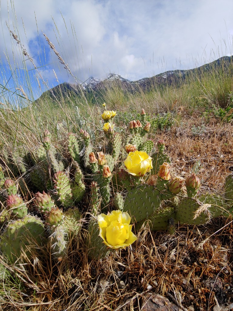
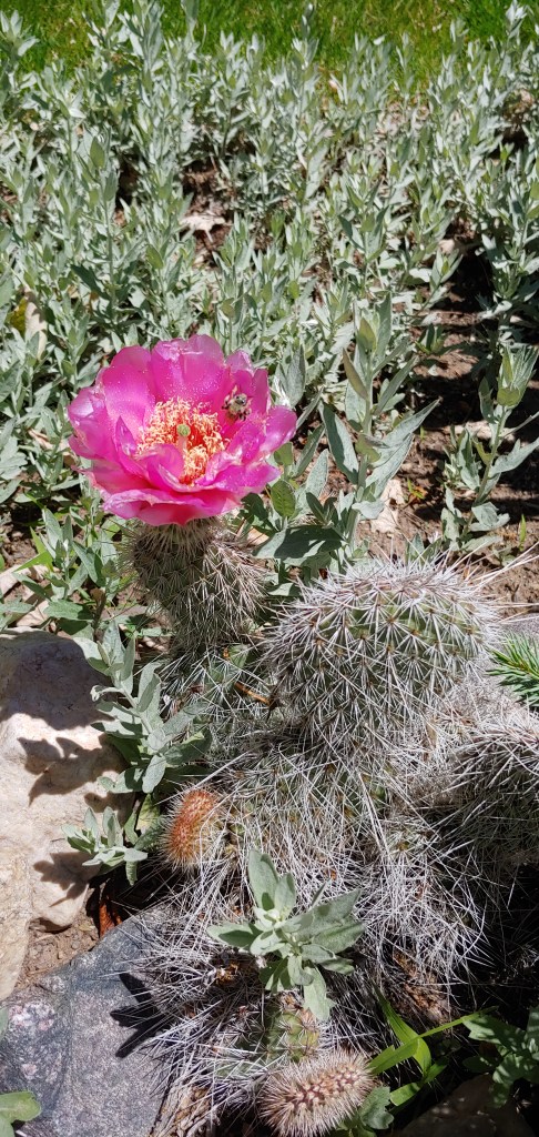
About two years ago I posted that one of our cactus plants bloomed after eight years. Well, it skipped a year and here it is again with one solitary bloom at 10 years old. The plant is surprisingly robust – every Spring we find it laying flat on the ground after getting flattened by the packed snow and deer wandering through our yard but it pops back up after a couple of weeks of sun!
Since our failed attempt at Gannett last September (2015) we learned a few things. As we prepared for another attempt we looked at a lot of the logistics of the hike, focusing on the routes in and out. Although Gannett Peak in WY (elev. 13, 804′) is ranked #5 of the State Highpoints in elevation, it is ranked #2 in difficulty, mainly due to the approach. In the best scenario the approach hike 1-way to the mountain is 17 miles and in the worst it is 25 miles; as a comparison, the approach to the summit of Denali (West Buttress route) is 13 miles …
We decided to use a combination route that had some new scenery and some old scenery. This year our approach would be from the Ink Wells trail head. The Ink Wells trail head is located on the Wind River Indian Reservation and we were required to be transported by a “guide” via pick-up truck to the trail head. There was a $135 fee for the 1-way ride as well as a required $30 Tribal Permit and Stamp to allow us to be on the reservation. But from an effort standpoint this approach was 10 miles shorter and had 2,000′ less elevation gain. We decided to take the Glacier Trail out as that was pretty familiar to us and allowed us the flexibility to return early if we attained the summit on Day 5 or 6, whereas the going out the Ink Wells route would required a scheduled pickup on a given day, as well as another set of fees.
With food for 7 days, technical climbing gear (boots, crampons and ice axes) and the required bear protection (spray and specific food storage containers) our packs were immense. We tried our best to limit extraneous weight but we still probably averaged 50#. Of course that number was elevated due to the 10# of camera gear that Joel lugged up!
Our trip began in Dubois, WY, where we met Dan. A stop to the Grand Teton Brewing Company in Victor, ID en route provided carbo-loading opportunities for all. The next morning we arose early as we had to drop one car off at the Glacier Trail parking lot and then drive to Crowheart, WY, about 45 miles away where we would leave the 2nd car and get our ride to the Ink Wells trail head. Everything “seemed” to go like clockwork (remember this statement.) It took about 1.5 hours to drive the 8 miles on a sometimes very primitive access road that wandered up the hills and into the river drainage.
We finally made it to the trail head and started our journey. This first day was very different from last year as instead of a 12 mile hike, it was only 6. We hiked up through the woods where we found probably the biggest pile of bear crap any of us had ever seen. I asked Joel to stick his finger in it to see if it was still warm but he wouldn’t so we hiked very fast and very loudly until we got into the open. From there it was up and over Scenic Pass and down through the woods to our camp at Echo Lake.
The second day comprised of a 2 mile hike down from Echo Lake where we then hooked up with the Glacier Trail and continued on another 6 miles to the end of the Glacier Trail (elev. 10,200′) where we intended to camp. Along the way there were several stream crossings we had to negotiate – some we easily hopped over while others required removing the hiking boots and donning sandals or sliding across large logs.
We met a fellow climber on his way out that indicated he had started his summit attempt from where we were going to camp. He left at 2:30am, got hopelessly lost in the boulder fields, and it took him over 3 hours just to get to the base of the mountain, which was only 600′ higher. This snafu resulted in a 13 hour summit day for him which we wanted to avoid at all costs. Based on this information instead of going for the summit on Day 3, we moved most of our camp through the boulder fields to the area called Tarn Camp (elev. 10,800′) so we would be in better position for the summit attempt.


We allowed 3 summit days in our schedule so that we could try to wait out any bad weather instead of packing up and turning around. As there was (obviously) no phone coverage in the area, we had to rely on the weather reports from several days prior. Unfortunately, they were pretty much wrong! Monday and Tuesday were riddled with storms, wind, and hail – although Monday did look questionable from the forecast we read, Tuesday and Wednesday were supposed to be clear and sunny…
Tuesday we got up at 3:30am and peered out of the tent. Again the weather looked questionable, but better. There were patches of clear sky but they didn’t stay that way long. We decided to wait another day to ensure that the apparent good weather pattern held.
Every time the sun came out we questioned our decision to stay in camp but then another storm would come flying through and we were happy we didn’t go. To pass the time Joel and I climbed up the pass closest to our camp and looked down onto the Gannett Glacier on the other side. Then we hiked back down to the area prior to the boulder fields where we had originally set up camp to retrieve some more food. Lastly, Joel climbed up and did a second recon hike to ensure that he knew the route up through the scree and boulders – at 4:00am with headlamps it was going to be difficult to navigate.
Wednesday morning finally arrived and although still windy and cloudy, we made the decision to head up to the summit. We would climb as long as the weather cooperated and would turn around if it got dicey – this was our last day to attempt the summit and none of us wanted to have to endure the horrendous approach hike if we failed again! Unfortunately at this time Dan made the decision to stay in camp and not continue up with us. Based on the weather reports indicating better weather, he hadn’t packed clothes that he felt would keep him warm enough. He didn’t want to chance getting high up on the mountain with inadequate clothing and so he cheered us on from below.
Joel and I ate a quick breakfast of PopTarts (YUM), Clif Bars (YUCK) and Energy Gel and headed up.Unfortunately we negotiated the scree and boulders so quickly that we missed the cairn that Joel had put up the day before and overshot the snow ramp we were supposed to hit to gain access to the mountain. Then I had the brilliant idea to keep going in the direction we were headed … all together we wasted an entire hour getting back to the area we were supposed to be at. OOPS!
Once we got onto the snow, things went well, we traversed across the first major snow field in just boots, then navigated through rocks to the access point where we would start the most technical part of the climb – the Gooseneck Glacier. We put on our crampons and headed up the 45degree slope (felt much steeper in some places!) The snow conditions were great and the dreaded bergschrund at the bottom of the glacier was still closed which afforded easy passage. The entire climb up (minus the hour we wasted) was about 3:45. Not bad for two old codgers! We both felt that the only real dicey part of the climb was the exposed summit ridge – one misstep and that would be the end. On the 70degree slope there was no way that you could self arrest.
The weather began to look menacing so we decided to head down. The trip down was uneventful and we looked forward to another yummy Mountain House dinner!


With most trips the return hikes are less eventful – less chatter on the trail and less photos taken. After 7 days on the trail, our trip was no exception … but wait. Do you remember that I mentioned that when we dropped one car off at the Glacier Trail head and one car in Crowheart, WY, that everything “seemed” to go well? As we were packing up, under bluebird skies to head out, Dan mentioned that he had looked and looked and looked and couldn’t find his car keys. Apparently he had secured his keys in his computer bag which he had left, locked, in our car … 45 miles away from where we were going to be. So, his car was sitting at the Glacier Trail head but he didn’t have keys … Oh well, we had 25 miles and 2 days to figure it out …
Our first day off the mountain consisted of traveling from Tarn Camp to Star Lake. This was about a 10 mile journey filled with the requisite stream crossings, mosquitoes, elevation gains and losses and overall aching feet. We camped at Star Lake in the exact same sites as we had during last years’ pukefest. Joel even remarked that there was a nice bunch of yellow flowers that had sprouted up where he had pooped – Huh, who notices that?
Once we settled in there were two fellows that appeared and asked to camp near us. We still aren’t sure what the relationship was but it seemed to be a guide and a very unhappy client. After cursing and screaming at each other for a couple of minutes, they didn’t talk to each other for the next 12 hours as far as we could tell.
From Star Lake to the trailhead consisted of a trail that went down to Double and Phillips Lakes, up to Arrow Pass and then down from the pass to the infamous 30 switchbacks and then finally to the car. Joel set off at a blistering pace. I had a hard time keeping him in sight and got pretty tired. We agreed to take a rest stop at 2 hours but I needed to sit down and take a break 90 minutes into it. At that time Joel remarked that to hike at my pace he would essentially be walking backwards (NICE ONE.) It seemed that the team was finally starting to unravel!
Figuring that the best chance to find someone in a timely manner to drive one of us the 45 miles to Crowheart to pick up our car and Dan’s keys was to send Joel ahead, we did just that. The main concern that I had was that he would overexert himself with the task at hand and not stop for food or water breaks. Not to worry … at the trailhead he happened upon 2 couples that were just finishing up their hiking. After hearing Joel’s tale of woe, they agreed to drive him to Crowheart … but only after they had lunch and gave him 2 sandwiches. No wonder Joel didn’t seem too hungry when he came back and rescued us!
We were finally in our vehicles and drove back to Dubois,WY, to find a motel and dinner. The first thing everyone did was take a nice long shower … thankfully. The next morning we met at a local coffeeshop and parted ways. Back to all the fun stuff waiting for us at home!


With our early morning summit of the MN Highpoint, we were in a good position to head down to WI to see if we could “bag” that peak in the same day.
Timms Hill is located in the UP of Wisconsin in the Timms Hill County Park. The hike to the summit (elev. 1951′) is a whopping 0.2 miles from the parking lot to the observation tower.No to offend any of our WI friends, but this one was a yawner. The recent rains again spawned the humidity and bugs that Joel and I seem to have forgotten about since we have moved to Utah. A few quick photos at the top of the observation tower and we made a hasty retreat to the confines of the car. Note that as unimpressive as it was when we were there, we both remarked that it would be spectacular in the fall with all the color in the trees and rolling hills.


