A mere 34 hours of driving was all it took to make it to the next state highpoint in our quest … We were able to manage 28 hours straight driving (one drove while the other slept in the back of the Jeep) from North Ogden to Jackson, Mississippi where we decided to call it a night.
We go up the next morning and headed to Florida where the highpoint is just a few miles south of the Florida/Alabama border. Lakewood Park, Florida, sits at an elevation of 345 ft., making it the lowest of all the US highpoints. The locals call the area where the park sits Britton Hill.
After spending time in the SE for work travels, I can say that this area is generally my least favorite of the entire US. It always seems that I get trips to our manufacturing plants or ingredient suppliers in the SE in the middle of the summer where the heat and humidity are absolutely oppressive. On this trip Joel and I were pleasantly surprised by the cool evenings, warm days, abundant sunshine and NO HUMIDITY! The hills, fields and forests were green and lush with very few leaves changing color yet.
I suppose I could live in the SE – at least for a couple months in the winter! No wonder all the “Snowbirds” flock south during the winter.
Crossed through Louisiana although I didn’t need that state highpoint.Rest stop near Pensacola, FL
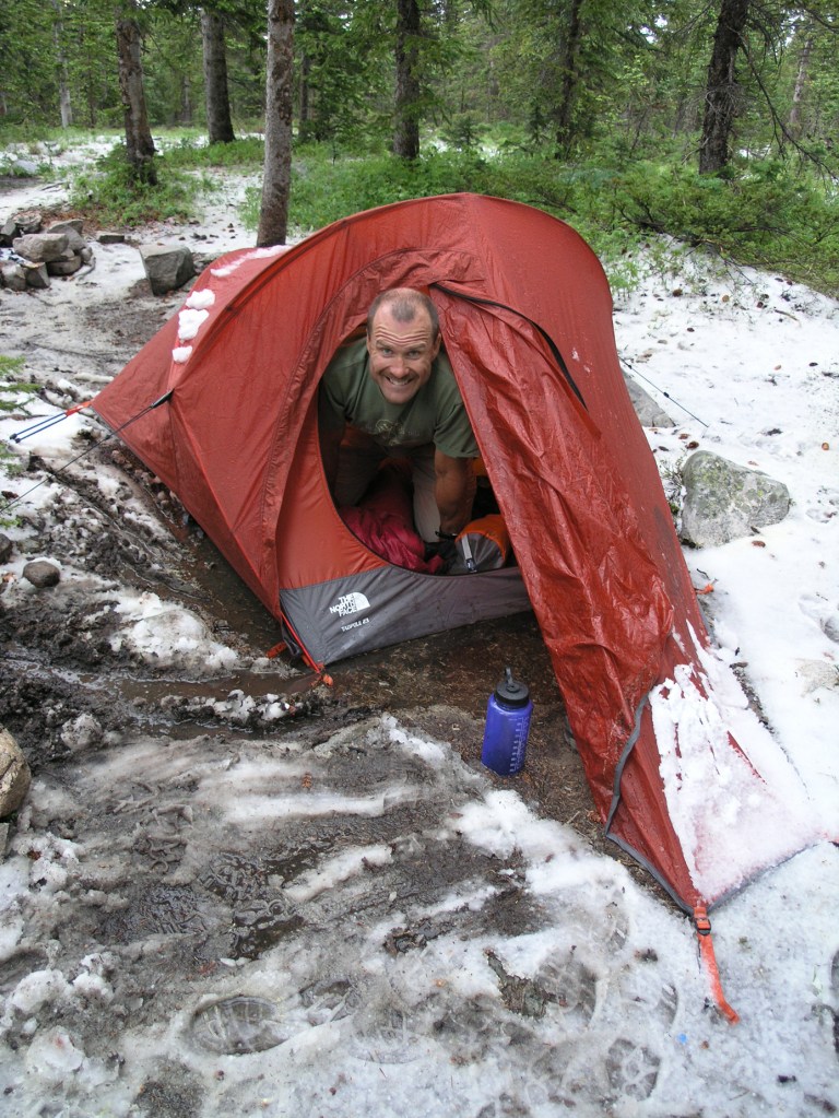
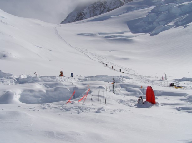
The last of the four planned State Highpoints for this trip was in Delaware. Initially it looked like a 5.5 – 6 hour trip from where we stayed in Elkins, WV. Unfortunately we ended up in the southern edge of the April Fool’s storm that hit the East Coast and about 1/2 hour out of Elkins we hit the rain. Torrential at times, this slowed our progress substantially and it took us almost 8 hours to get to the site. Once we made it to the highpoint at 448 ft. we couldn’t find the benchmark. Reading the documentation again, we found it was approximately 75′ from the sign which was odd… Once we found the concrete cut-out, there was a 2″ puddle of water covering the benchmark. I tried to bail out the hole but since 2″ – 3″ of rain had fallen, the ground was saturated and it just kept filling up!
All in all, this highpoint may have been the one reached in the most adverse of conditions! After a few goofy photos, we returned to the car, completely drenched. Next stop Manheim, PA for the night. We stopped at a tavern recommended by the hotel and were not disappointed. Dad enjoyed and Irish Coffee or two as he tried to warm up a bit!
Hat #1 – Schell’s BreweryHat #2 – Highpointer’s ClubGiant Hamburger at the Quentin TavernHad to bail out the benchmarkHat #3 – Gilroy Garlic Festival
The route is well marked with red blazes on trees and rocks.Summit of Mt. Frissell in MA.I need longer arms to do this!Mt. Frissell viewed from the summit of Round Mt. The CT State Highpoint is on the lefthand shoulder of Mt. Frissell (not visible in this picture.)
A cancelled ingredient supplier audit in Montreal afforded me the opportunity to take an extra day on the drive from MA to Montreal. I decided to look at Mt. Frissel and Mt. Greylock as opportunities to hit the CT and MA State Highpoints along the way.
The CT State Highpoint is interesting in that you drive to Salisbury, CT, then up a 1 lane dirt road that had areas of active logging on it (luckily I avoided meeting one of the trucks on the road) and then on to the trailhead which is actually in MA. From there you hike up and over Round Mountain and then up to the Summit of Mt Frissell. Quite confusing, but the summit of Mt. Frissell is in MA so you then have to skirt around the southern “shoulder” to find the highest point in CT, which is marked by a pin and a pile of rocks!
It was a nice, short climb (about 3.2 miles round trip) and although the skies were threatening, no snow fell while I was there. It was a brisk 22 degrees according to the thermometer on the car.
I then headed the 37 miles north to Mt. Greylock, only to find that the summit road was closed due to hazardous road conditions. There are trails down lower that I could have taken that hook into the Appalachian Trail, but since it was around a 16 mile roundtrip and it was already 3:00pm, I decided that I will tackle that one at a later date, maybe with Joel in tow.
Mt Marcy (New York State Highpoint) or Mt Mansfield (Vermont State Highpoint) were other potential options for this trip but now look to be snow covered so they too will wait.
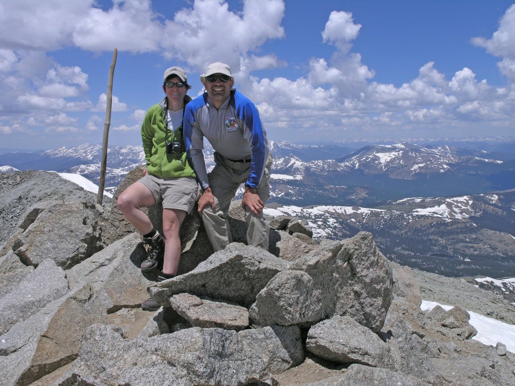
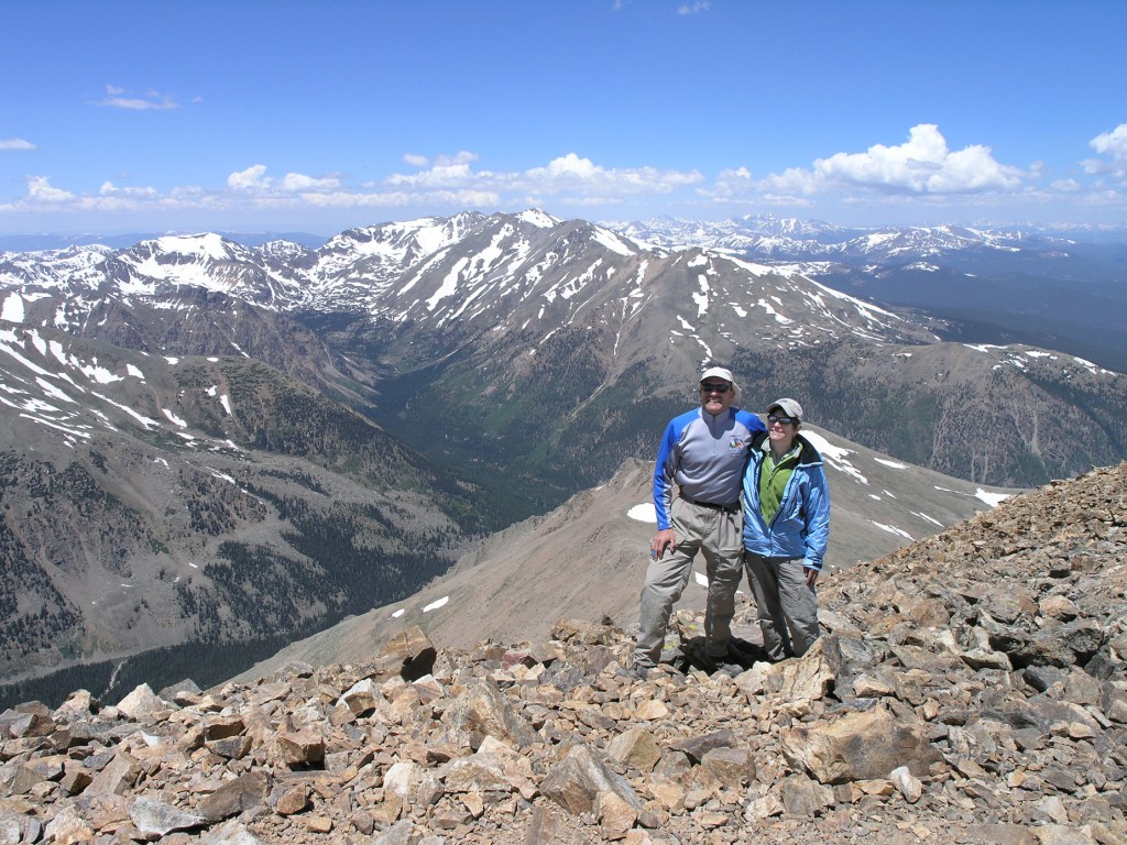
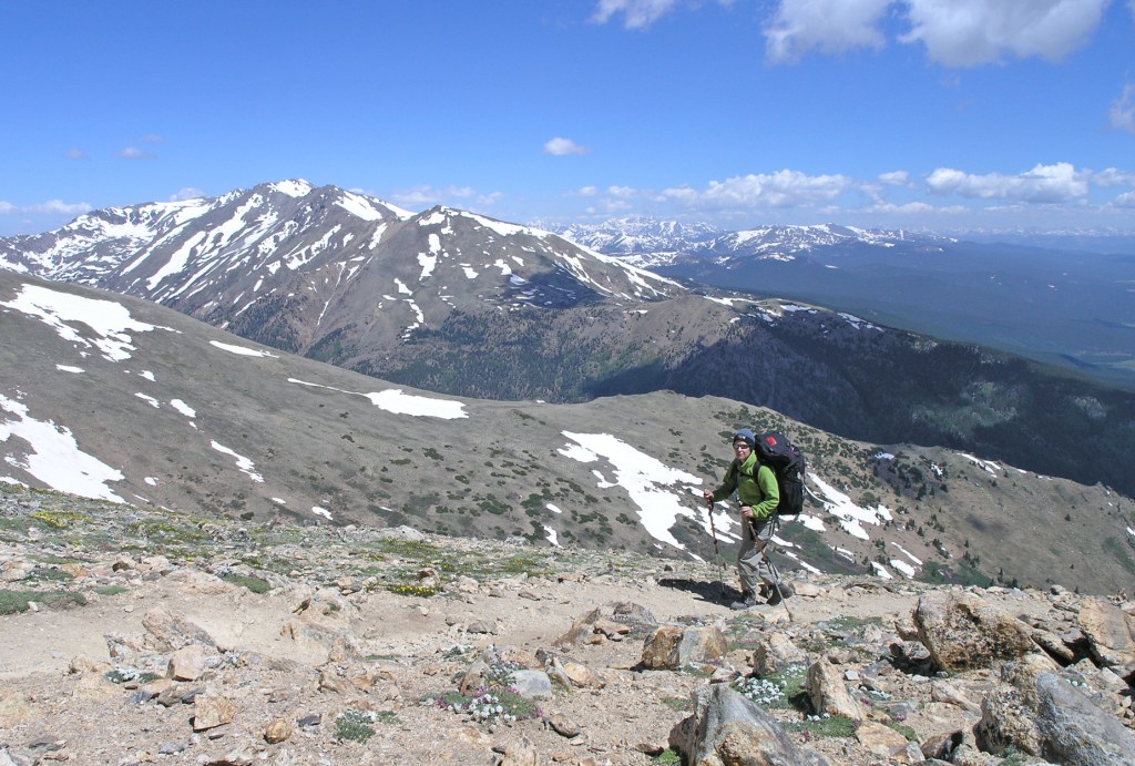
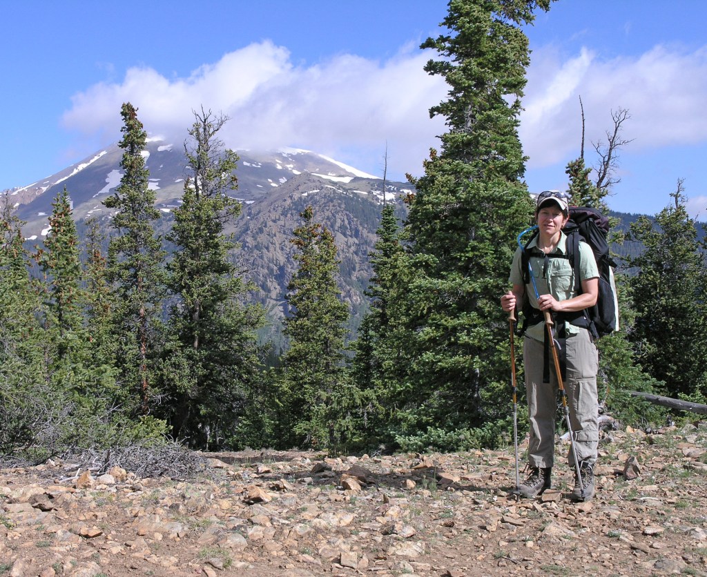
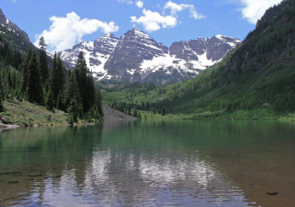
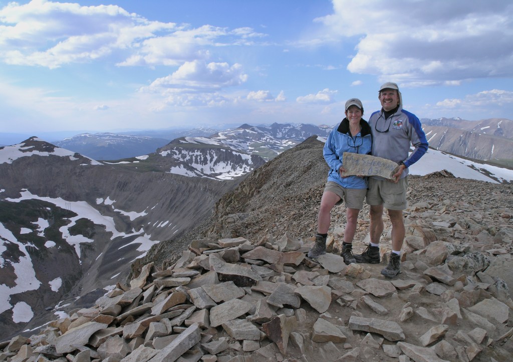
Colorado was another of the original blog entries that disappeared and I am unable to cut and paste over to the new site. Unable/unwilling to reconstruct our narrative from 12 years ago, we will just provide photos with the understanding that this was a great trip! A whirlwind tour of the Rockies included a week of summits (Mt. Elbert – 14,433′, Mt. Massive – 14,421′, Mt. Sherman – 14,036′ and Mt. Sopris – 12,965′) culminating with sleeping on the summit of Mt. Massive on the 4th of July, watching fireworks down below, 360 degrees around us. Then Joel threw up, barely making it out of the vestibule. Yay! Fun times! HAHA
Mt. Massive summitMt. Elbert summit – Colorado HighpointOLYMPUS DIGITAL CAMERAOLYMPUS DIGITAL CAMERAThe days of big packs and small tents. Now we travel with big tents and small packs! Nice dye job, Alison!OLYMPUS DIGITAL CAMERAOOPS – at least the trusty Tadpole was fairly watertight. Didn’t realize when we pitched it in nice weather that we were going to wake up in a lagoon!OLYMPUS DIGITAL CAMERAOLYMPUS DIGITAL CAMERAMaroon BellsMt. Sopris summitPizza in Leadville, CO. Thanks for taking the photo with my mouth full of food!Mt. Sherman summit
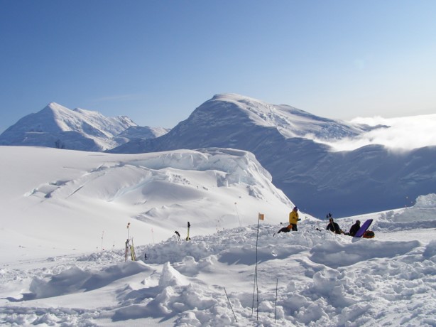
Again due to Alison’s chaotic, ever-changing work schedule, our vacation had to be moved around. On a whim we went to the permit site that issues permits to climb Mt. Whitney in California. The Eastern Sierras is about a full day drive from our house so when we found a date with open permit space, we took off for the hills. As a note, the “normal” process to climb Mt. Whitney is to submit an application in mid-February to the lottery system in hopes of being chosen out of the 20,000 people that apply each year. So, we felt quite lucky to find the open permits when we did!
We drove to an old (but still functioning) mining town in Nevada called Tonopah for our first night. An old hotel there was noted by travelers as a favorite. They have restored the Mizpah Hotel wonderfully and it was a fun change from the normal Super 8’s! As a benefit, there was a coffee shop across the street that opened up at 4:00am! Perfect for early risers.
After picking up our permit in Lone Pine, CA we then drove up to the Whitney Portal where the trail starts The town of Lone Pine is very famous for the foothills (Alabama Hills) as over 350 movies have been filmed in an around the rocks and plains of that area from the 1920’s to present day. Some of the more famous movies filmed there are High Sierra, Gunga Din, The Lone Ranger, and The Virginian all the way up to more recent movies including Gone in 60 Seconds and some of the Star Trek Movies.
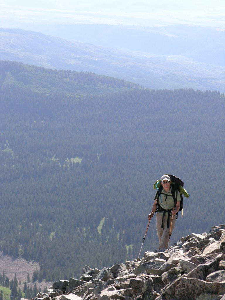
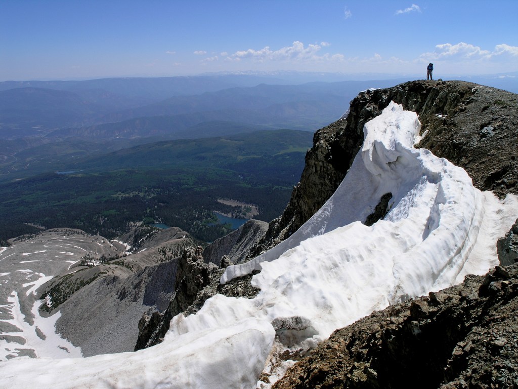
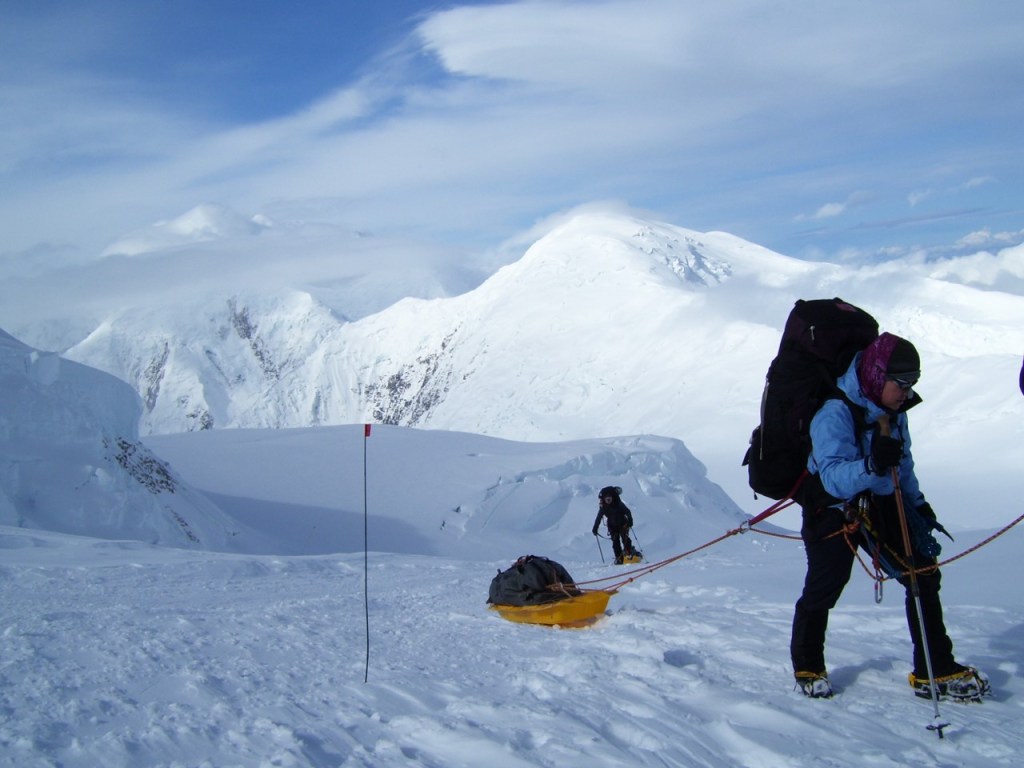
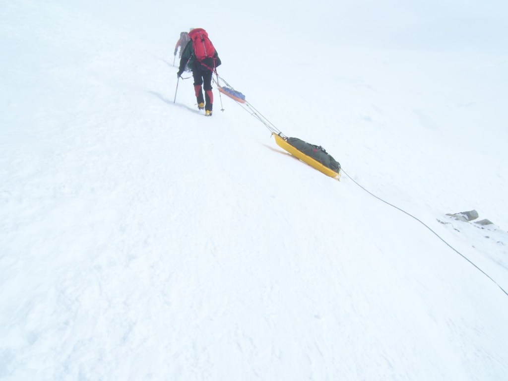
We slept at the Trailhead Campground (elev 8365′) for an early morning start by headlamp. It took us about 5 hours to go the 6.2 miles and 4,000′ elevation gain to get to Trail Camp (elev 12,000′). We stayed overnight there and then went for the summit the next morning. Another 3.8 miles and 2,000′ elevation gain and we were at the summit of Mt. Whitney (14,501′) – the highest point in California and the contiguous US!
Tonopah Mining ParkRestored Mizpah Hotel in Tonopah, NV where we stayed a couple of times.Lobby & Bar area of the Mizpah Hotel.Joel meets an old friend at the coffee shop.Setting up camp at the Whitney Portal Trailhead Campground and yes, we remembered the tent poles this time!Early morning start by headlamp.Three curious deer we saw past Pine Lake.Are we there yet? Looks like I am chewing on a bunch of rocks?Trail CampUp before the sun with our headlmps.Summit marker that hubby bought – apparently the mountain is growing because it states 14,497′ and then 14,501′!Happy Summiters!Trail Crest of the Mt. Whitney trail.Campground at Lone Pine where we stayed after descending.Mt. Whitney at sunrise from the Alabama Hills area of Lone Pine, CA. The Mt. Whitney summit is the large peak on the right of the two spires.
Yesterday was a travel day from my first audit in Van Buren, AR to today’s audit in Memphis, TN. The route took me about 17 miles from the Arkansas State Highpoint – Mt. Magazine – Signal Hill at 2753′. I drove most of the way in the early dawn hours because there was a Winter Storm Warning out for my intended destination in TN and I wanted to try and avoid as much of the bad weather as possible. The western part of Arkansas had had snow the day before and it was funny to see more snow at the highpoint than at our house at 4800′ elevation! There was between 4″ – 5″ on the ground and I had to “break trail” in my tennis shoes … another case where I was ill prepared for a summit attempt! The trail was pretty easy to figure out as I was able to follow assorted critter tracks. Overall it was about a mile roundtrip to the car and I ran most of the way, again trying to get to the other side of the state before the storm hit.
About 4″ – 5″ of snow on the “summit.”I finally figured out how to use the self-timer on my camera!From the parking area the “route normal” is about 1 mile roundtrip.View from one of the roadside overlooks of the Petit Jean River Valley – someone else made the nice little snowman!
Back for my second attempt at the “Savage Mountain” as Dave and Sharon call it, we decided that an early morning start was warranted for Mt. Humphrey’s (12,633 ft.) Once again the weather reports promised crappy weather by late morning. We never changed our clocks over to Arizona time so we really weren’t sure what time we headed out but I think we were at the trailhead by 6:30am (or was it 5:30am?) As promised, the weather rolled in and it started to snow on the summit just as we got there. No time for a “group” shot on the summit, we each snapped a couple pictures of each other and bailed down the trail. We hiked down in rain most of the way and soon found out how waterproof our clothes really were (or were not!) Obviously snowshoes were overkill on this trip but better safe than sorry.
On the way to Kanab, UT we were able to see the beautiful Vermillion Cliffs area. Then an overnight stay in Kanab and home we went. Just enough time to wash a few clothes, sleep in for one morning, and off to NY and ME for my next business trip.
Forest fires around Flagstaff made for a hazy sunrise.Joel heading up to one of the many false summits on Humphrey’sARGH … its snowing AGAINVermillion CliffsKanab, UT – Huh?Joel posing in the KANAB Pawn Shop under one ot the owner’s trophy bucks.
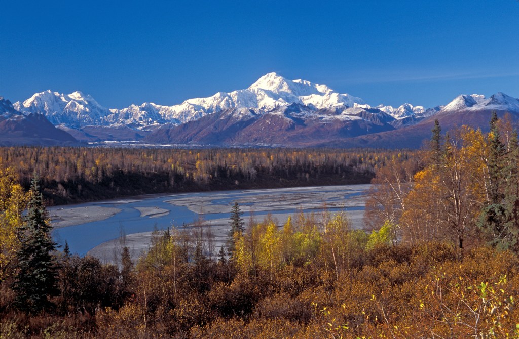
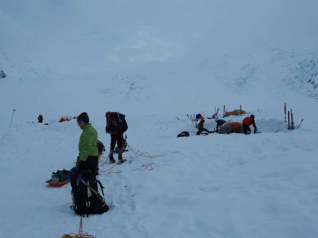
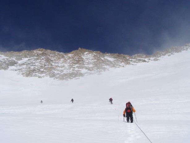
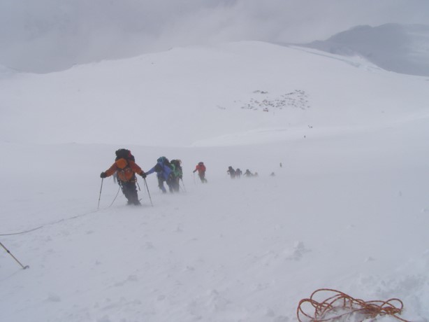
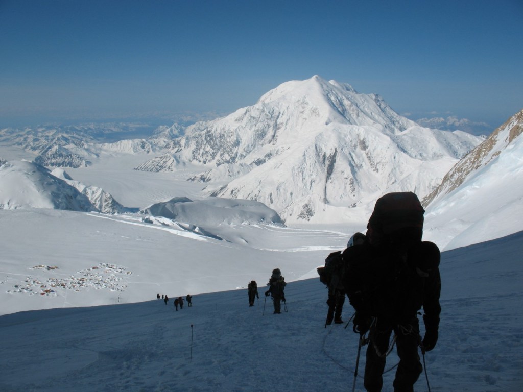
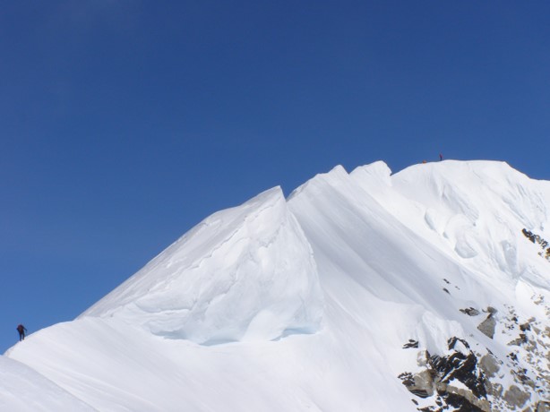
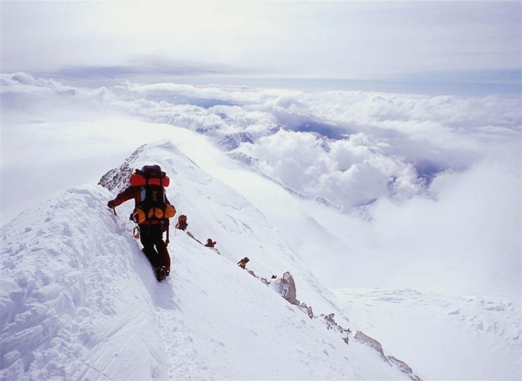
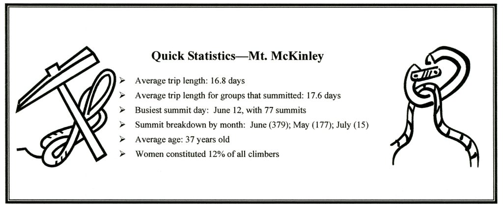
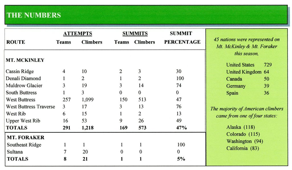
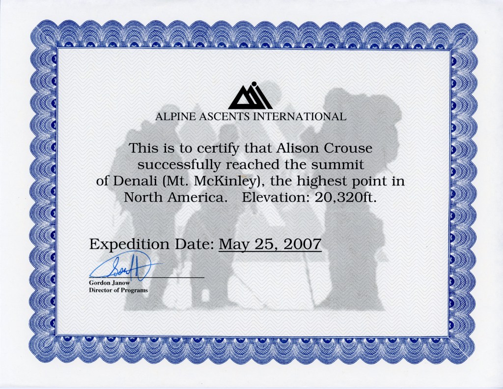
Alphabetically, the Alaskan Highpoint is second on the list to be republished and it was also the second one that was tackled in my Highpoint Journey (after Mt. Rainier) – not sure how that happened! What I do know is that this it the one Highpoint that had the longest original writeup – the expedition was 21+ days long and I think that I wrote a page and added photos for each date. This was also one of the blog entries that I lost and most of the photos disappeared. In order to keep this blog entry as short as possible and as interesting as possible, I am not going to include much in the way of commentary but let the pictures tell the story.
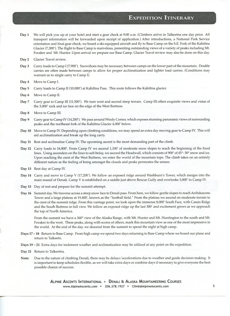
In essence, we started this trip with a nice, orderly itinerary (see below.) Unfortunately, after Day 10, everything was thrown out the window as we got stuck at Camp IV for 9 days due to 60 – 80 mph winds at the 17,200′ Camp and we couldn’t move up. We had one shot at getting further up the mountain, summiting and returning to Base Camp so we could make our flights out of Anchorage and then home – the Mountain Gods ended up smiling upon us. Days 11 – 21 below were compressed into 2 1/2 days! Who needs a stinkin’ plan anyways?
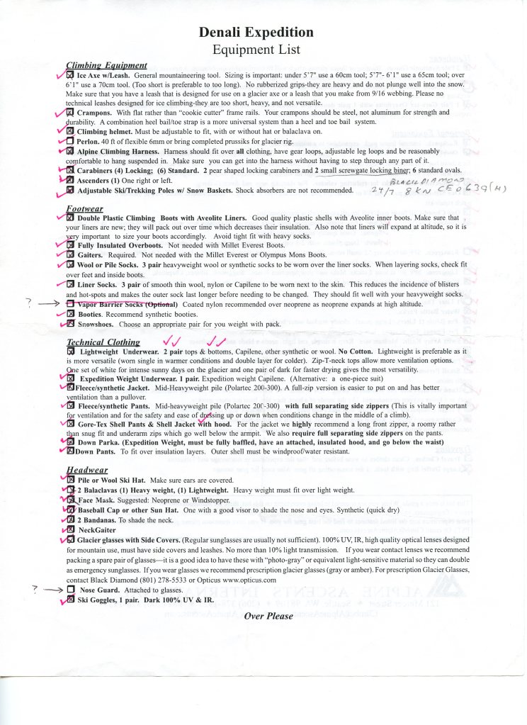
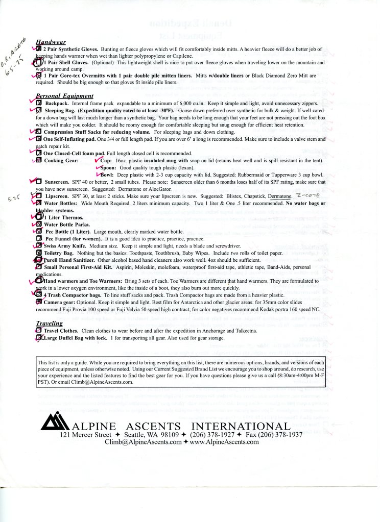
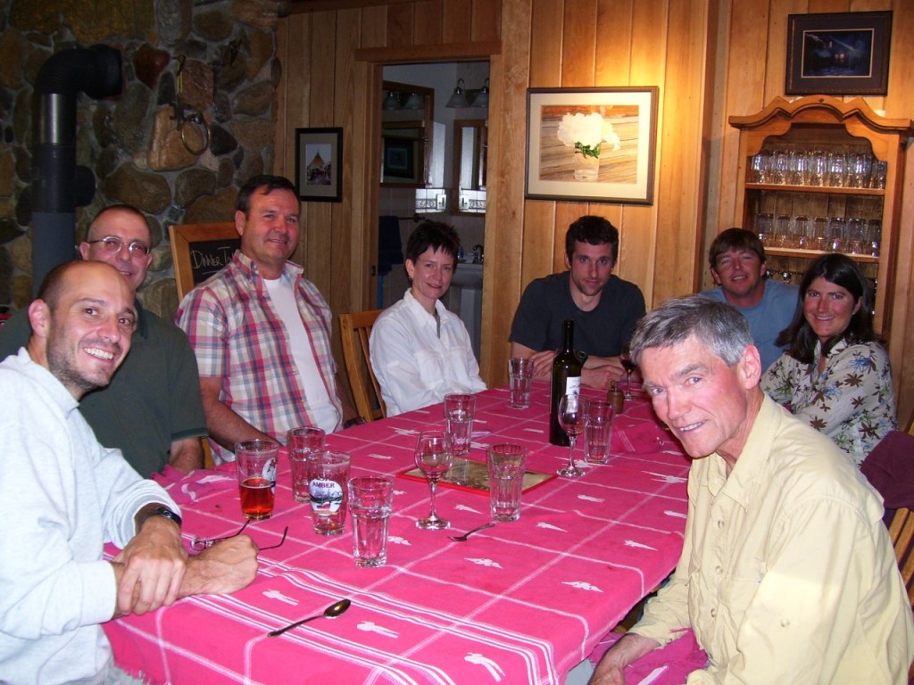
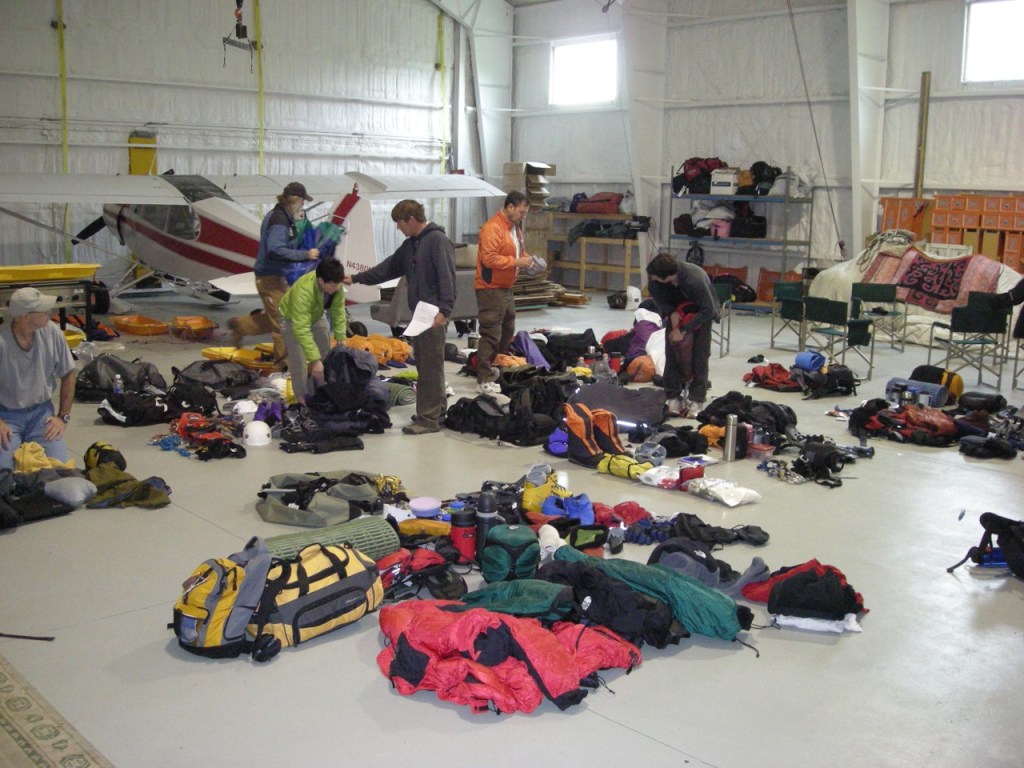
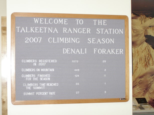
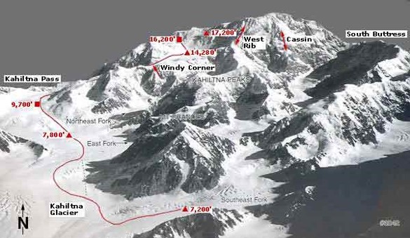
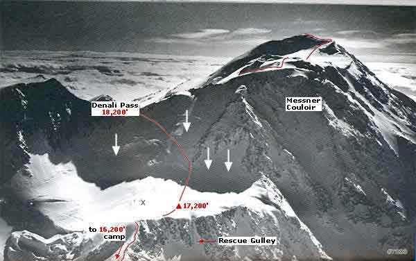
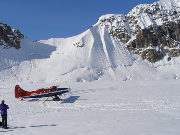
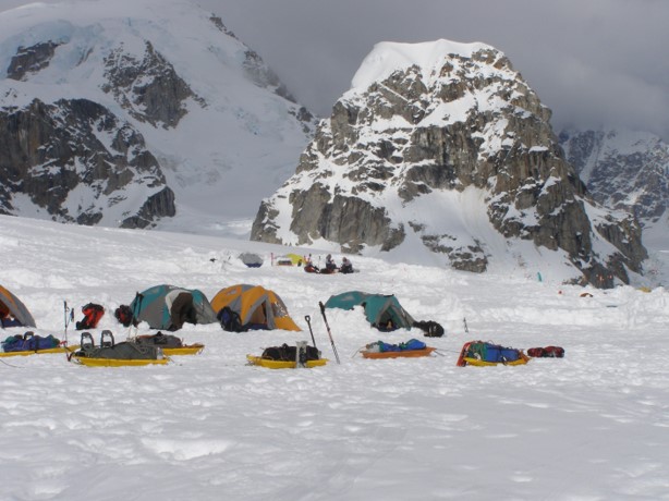
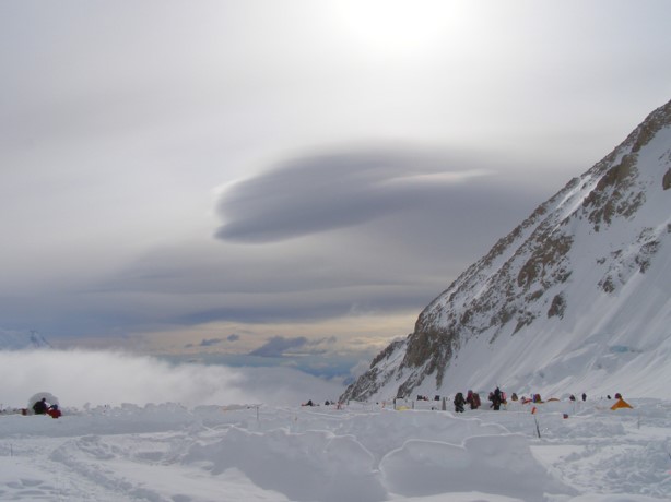
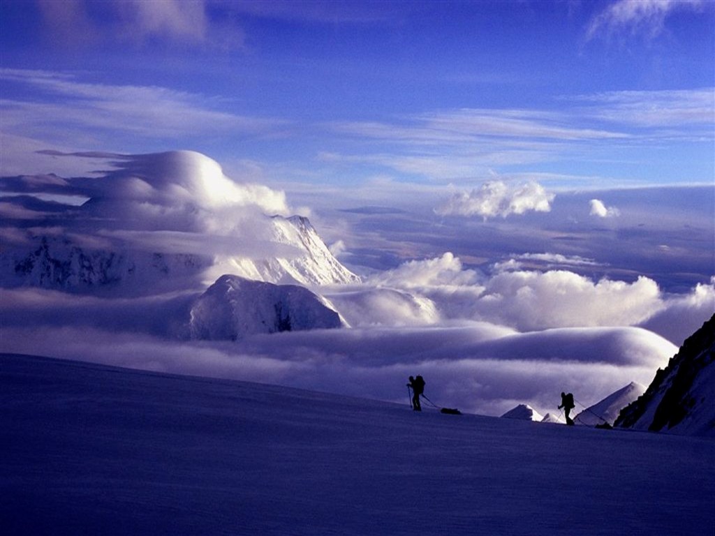
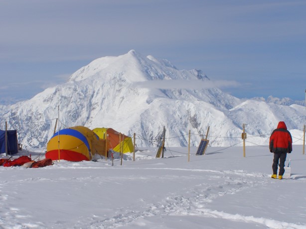
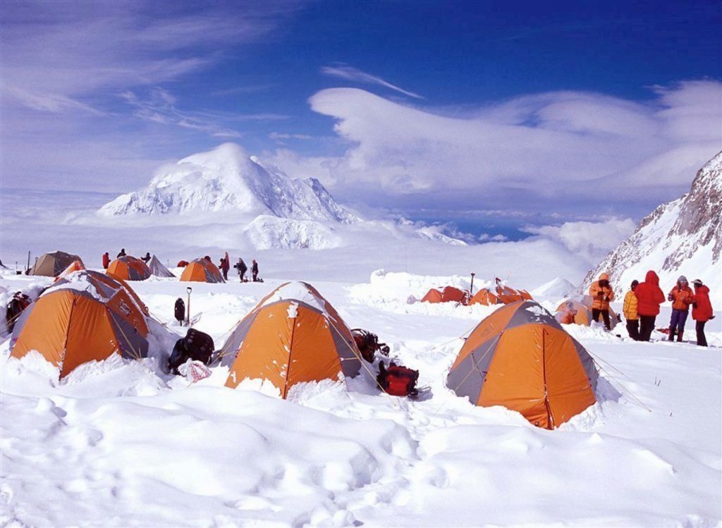
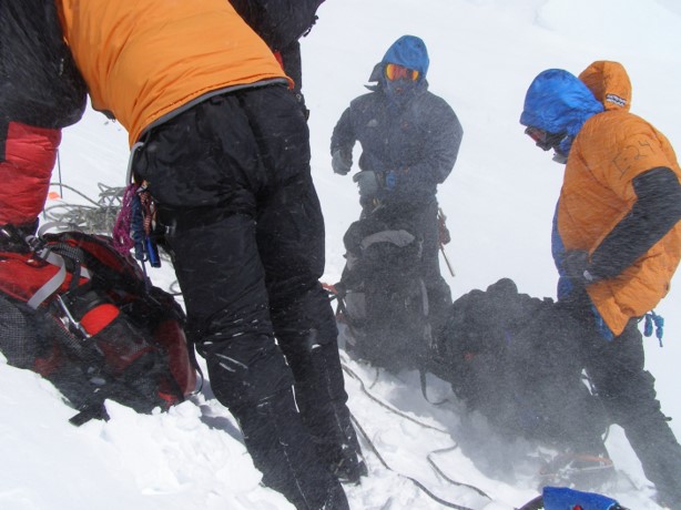
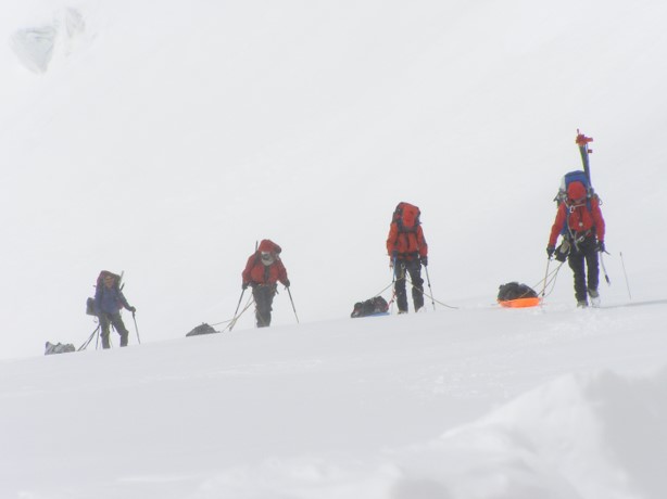
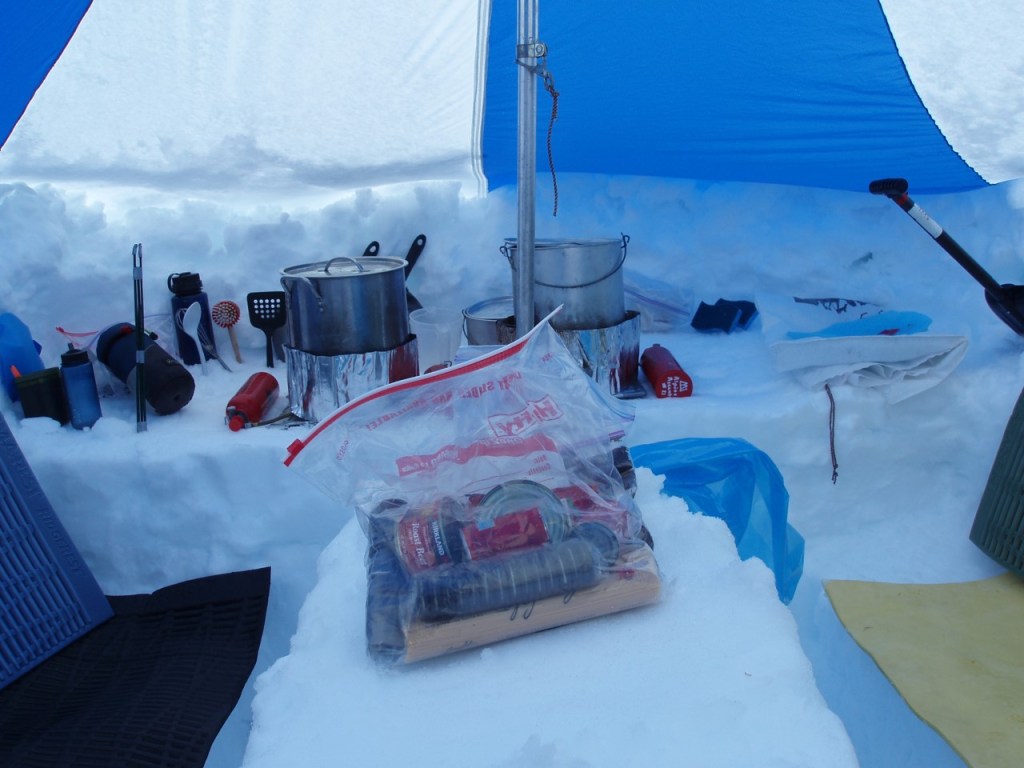
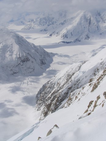
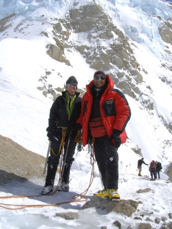
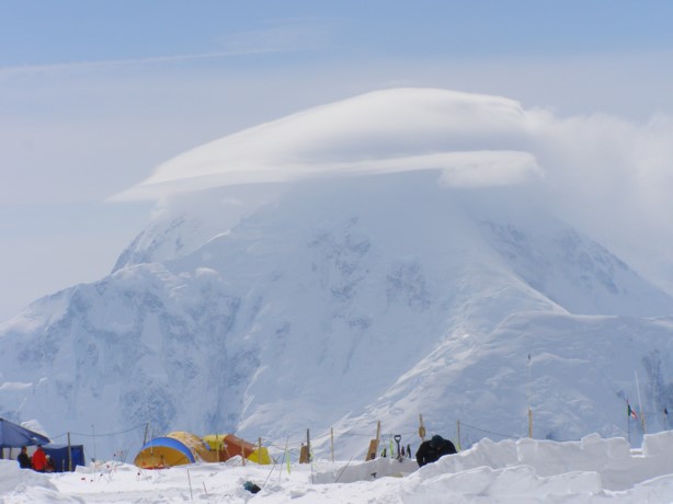
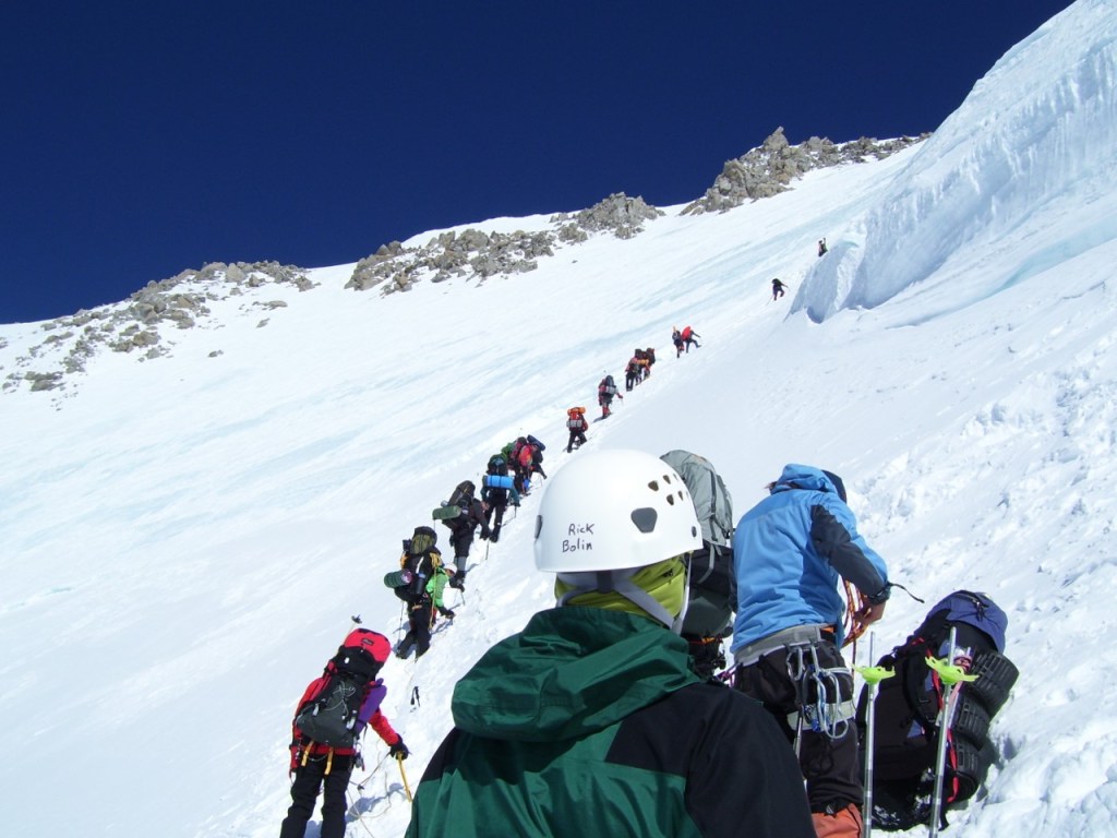
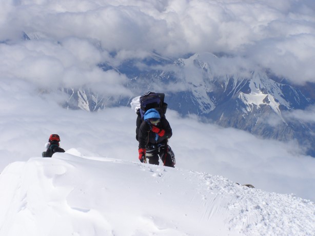
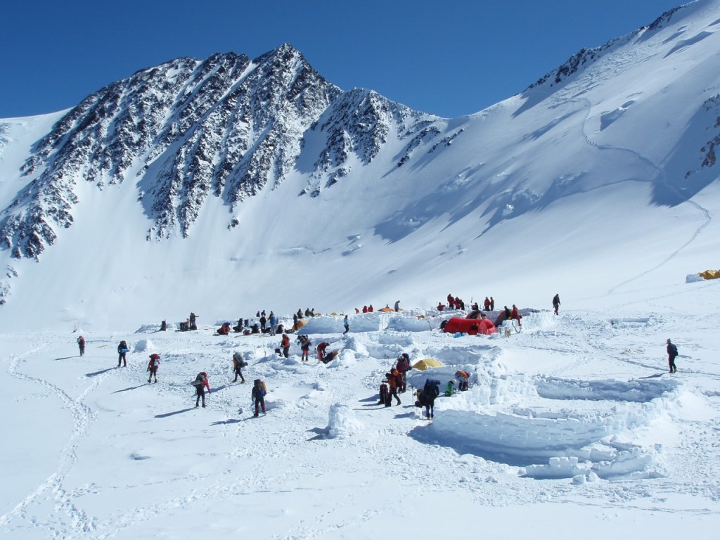
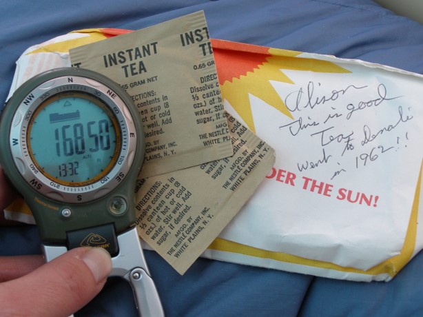
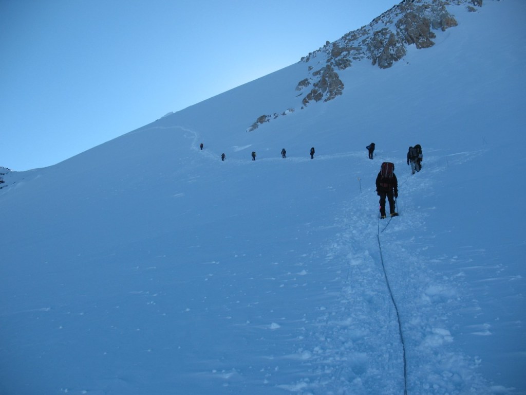
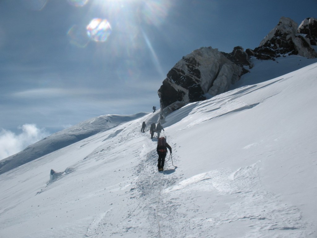
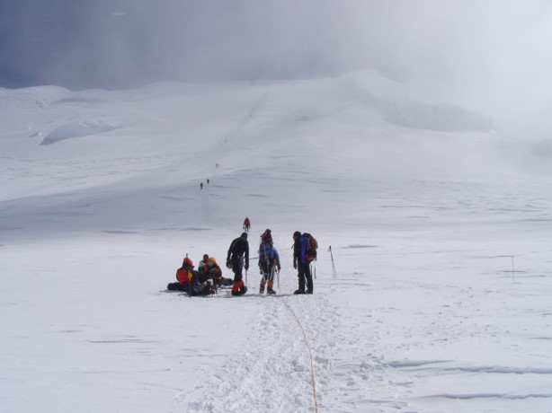
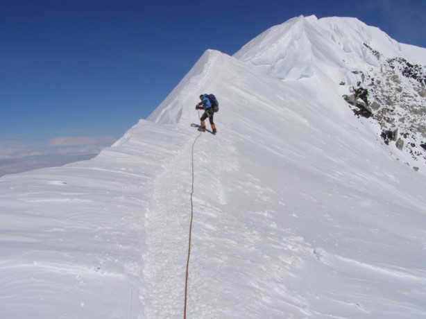
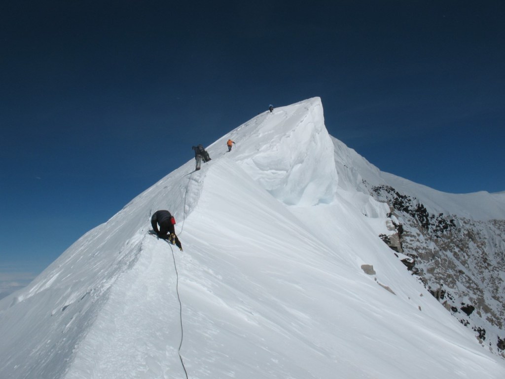
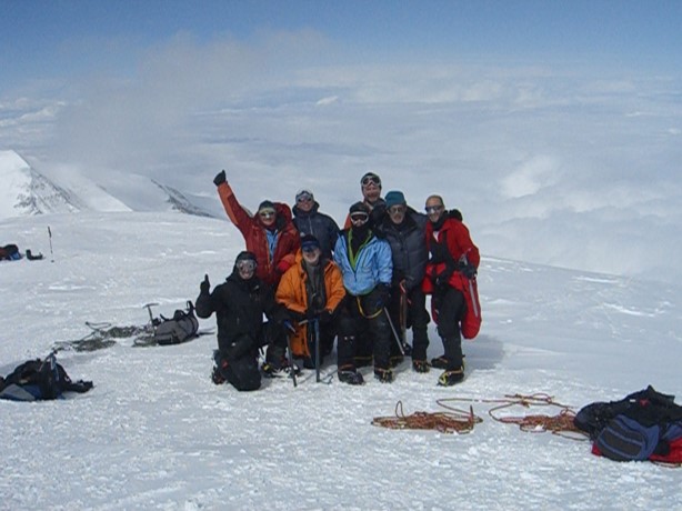
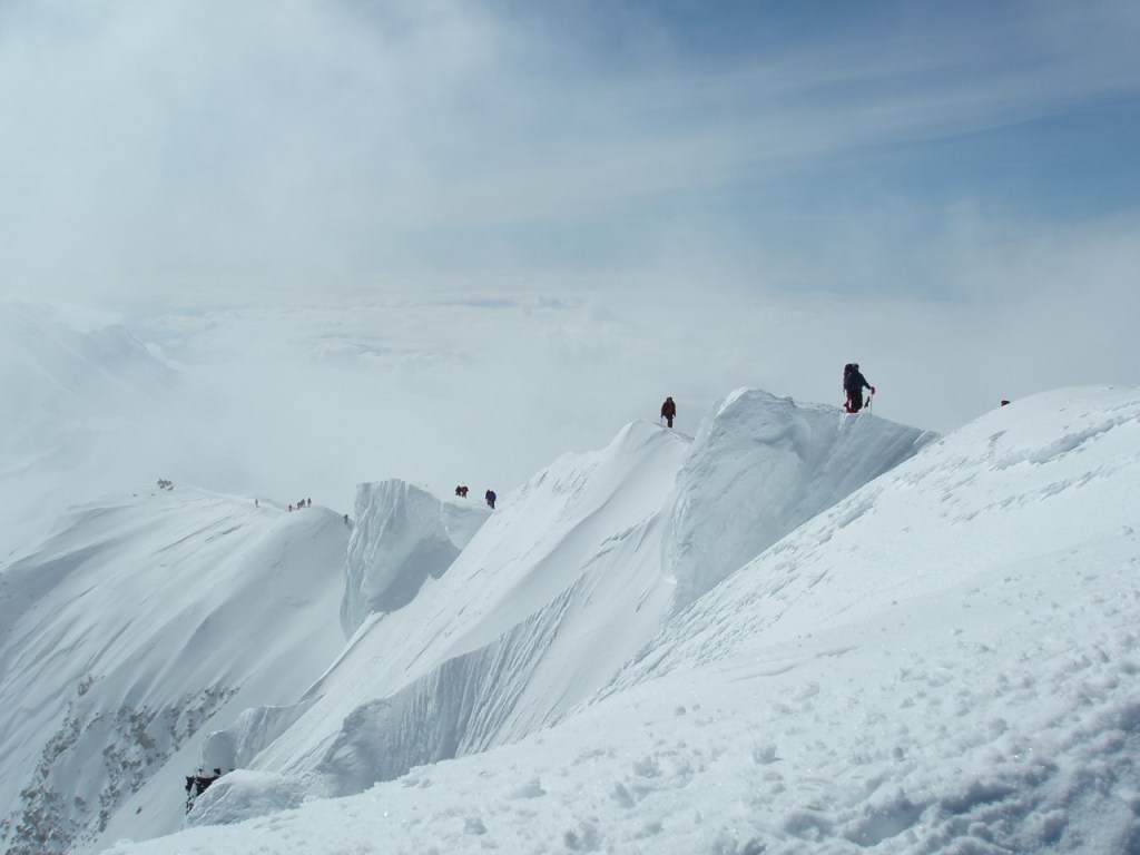
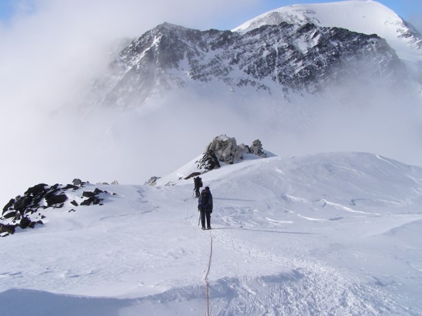
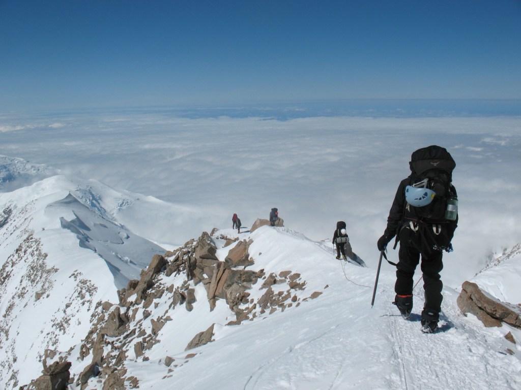
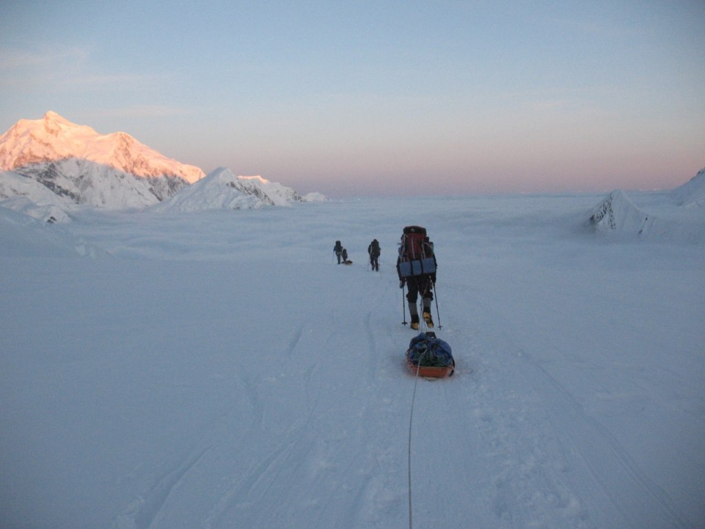
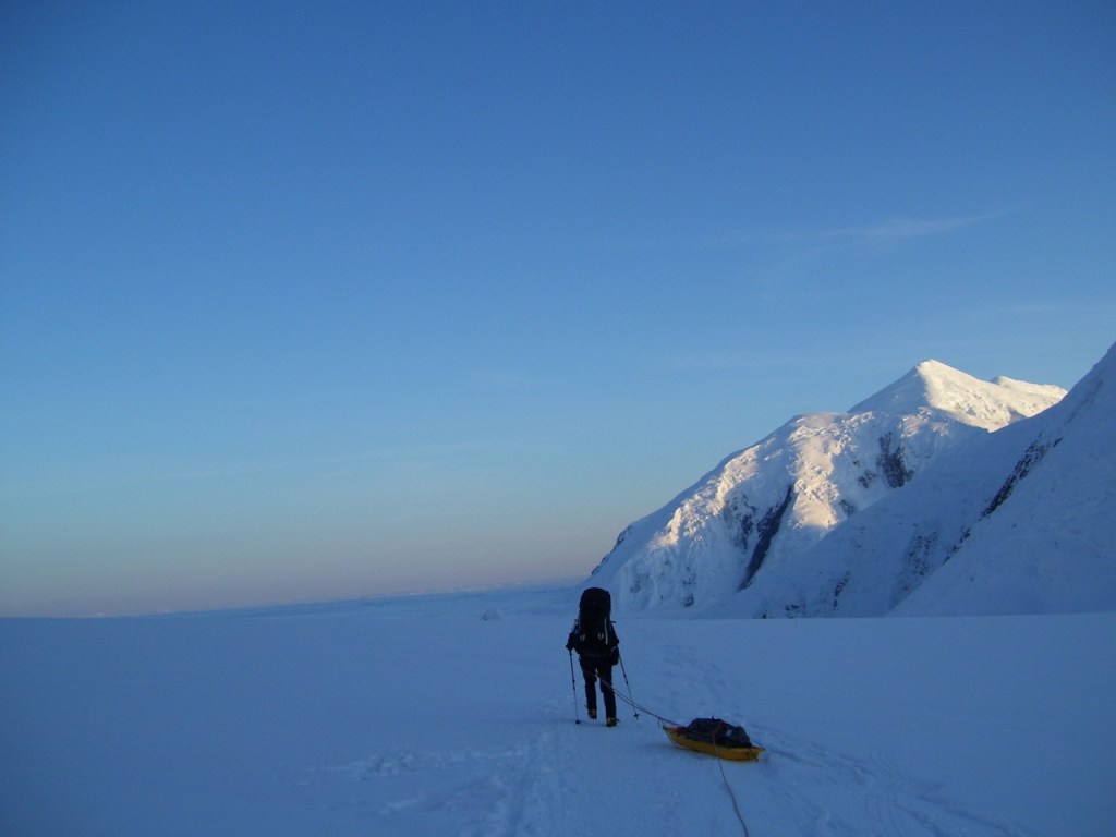
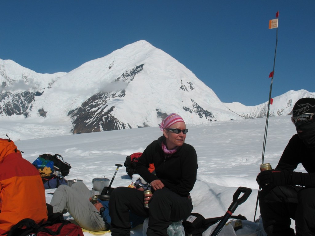
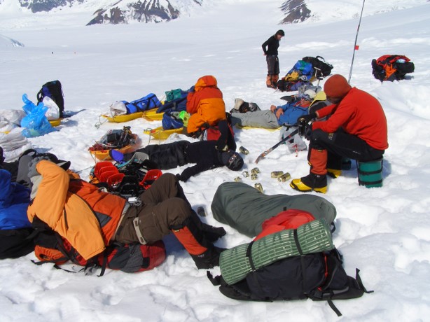
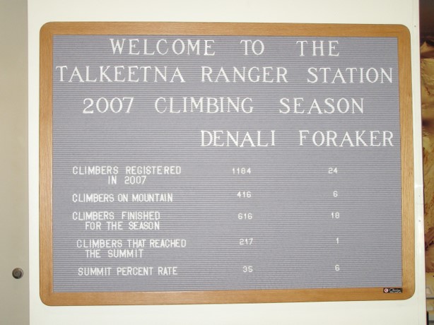
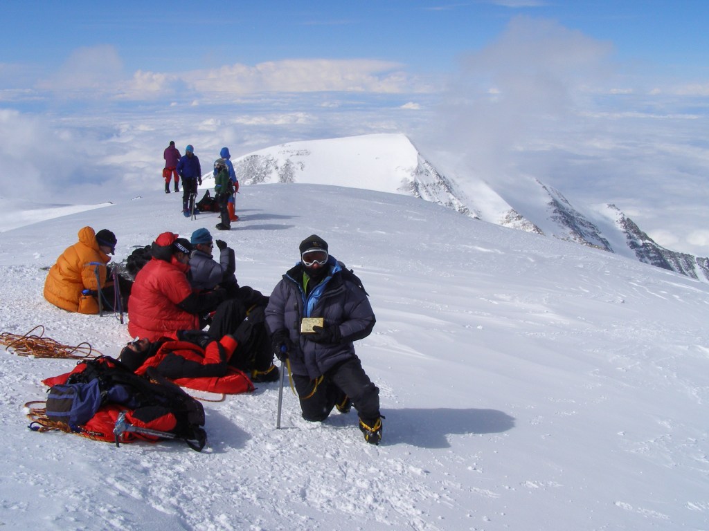
First time to meet the team in Talkeetna at the Fireweed Station B & B. Todd and Winslow Passey were our guides and they are the two in the back right side of the picture. My tentmate Sebastian is the one in the grey shirt next to me. Poor guy , everyone else had paired up and knew each other but we were the “odd men out” and got stuck sharing a tent.Gear check.Climbing statistics when we checked into the Ranger Station in Talkeetna.Our West Buttress Route (continued on the next slide.)Base Camp on the Kahiltna Glacier.Big Ass packs! We started out with 70# of personal gear and 50# of group gear apiece. As we made multiple/double carries to most of the camps, these loads slowly got lighter and lighter – we would carry about 1/2 up to the next camp and then descend, spend the night at the lower camp and then take the other 1/2 up the next day. But the first couple days we didn’t double carry so the beasts were huge.Going around Windy Corner. The stupid sleds never tracked right and they were swinging like a 50# pendulum alongside of you, trying to pull you off your feet!14K CampClimbers approaching 14K camp – photo courtesy Joel Schenk!The rangers at 14K Camp would post on this board the weather conditions above us, letting us know if we should attempt to move up to 17K Camp. For nine days we would get up, look at the board and see that there were 60 – 80mph winds above us, go back to the tent and do basically nothing!14k Camp scene – photo courtesy Joel Schenk!On the 9th day we decided to try and make a carry up the headwall and to the ridge above.Nope! We were able to stash some equipment at the bergschrund but ended up going back to 14K Camp.Our cook tent at 14K Camp. YUM Dinner. As long as there was a roll of Oreos, everything was good!During one of the “down days” we hiked to “The Edge of the World” and look who showed up! Pre-husband Joel was with another group and we ended up at 14K Camp at the same time – what are the chances?!Finally a clear day as we leave 14K Camp and ascend to the headwall.We were not the only ones that made the decision to move up today!17K Camp with the route up to Denali Pass on the right-hand side.Instant tea from Dad that I took on the trip – it was left over from his 1962 trip to Denali – not very good!Up to Denali Pass before the sunrise.Rounding the corner near the top of Denali Pass.The “Football Field.”Summit RidgeYea Team!Looking back on the summit ridge and the hordes of climbers coming up after us. Caused an “exciting” traffic jam on the way down as multiple rope teams had to pass each other on some rather narrow ridgelines.Heading back down to Denali Pass.17K Ridgeline – one of my favorite photos as it shows how dicey some of the route is – contrary to those that describe climbing Denali as “just a long hike…” – courtesy Joel Schenk!Due to our compressed schedule, the route that took us 19 days to get to the summit, we descended in a little over a day.Our wonderful guides had the foresight to bury 2 cases of celebratory beer in Base Camp which we gladly enjoyed while waiting for our flight off the glacier. I don’t think beer had ever tasted better!ARGH We made it!Mountain statistics when we checked out at the Ranger Station in Talkeetna.OLYMPUS DIGITAL CAMERA
Almost due north of the Florida state highpoint is the Alabama highpoint of Cheaha Mountain at an elevation of 2,407 ft. The Cheaha State Park lies inside the Talledaga National Forest. No Ricky Bobby sightings …
This was the second of three “drive-up” highpoints for this trip, unfortunately with the park closing at sundown, and sundown coming before 5:00pm, we were not able to get to this one fast enough from the Florida highpoint earlier in the day. We ended up staying the night in nearby Anniston, AL, where Joel got his first good taste of a Crawdad Po’Boy! (The first ones we had were in Jackson, MS, and they were a greasy fried mess – not very appealing!)
Of noteworthy mention is the fact that out of the 50 states, Cheaha Mountain in Alabama ranks 35th and it is taller than the WI, MN, and MI highpoints, which were our first options to tackle over Thanksgiving (until we saw the forecasts for bad weather up north.)
The highpoint is marked by a large stone lookout tower, campground, motel and a small general store. We were able to pick up a jar of pickled turkey gizzards at the store as our contribution to the Schenk family Thanksgiving in New Ulm, MN. Only a couple takers on that one! YUCKOLA
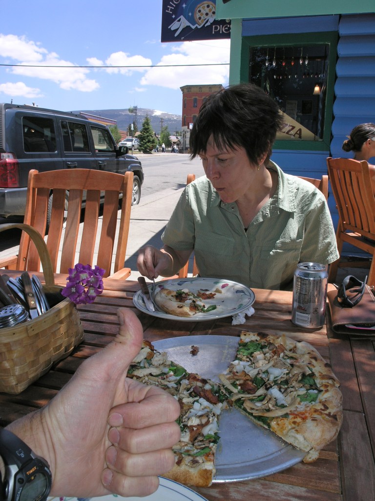
Beautiful view from the Cheaha Mountain Lodge.Crawfish Po’Boy and Sweet Potato Wedges!09-`Our contribution to the Thanksgiving dinner table in New Ulm, MN.
In an effort to bring some order to an otherwise chaotic world, I have decided to re-publish all of my 50 State Highpoint Entries for your amusement. They will be in alphabetical order, with the first entry Alabama.
Note that there is some cutting and pasting and copying involved as I try to pull photos and entries off the old blog. Since the original blog is over 15 years old, a lot of the formatting and photos may be re-sized and some have even disappeared but I will do my best. In most cases I am just going to copy and re-publish the original blog without much new dialogue. There will be exceptions, for example the second entry (Alaska) – all the photos I had posted in 2007 when I made those entries have disappeared so I will have to recreate that one.
Anyways, some entries will be good and some will be pretty short but you should have 50 days of amusement!
The blog titles will include the State, Highpoint, Elevation, Date Completed and the Completion Number – for example the first one will be: